
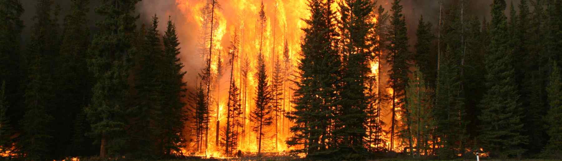

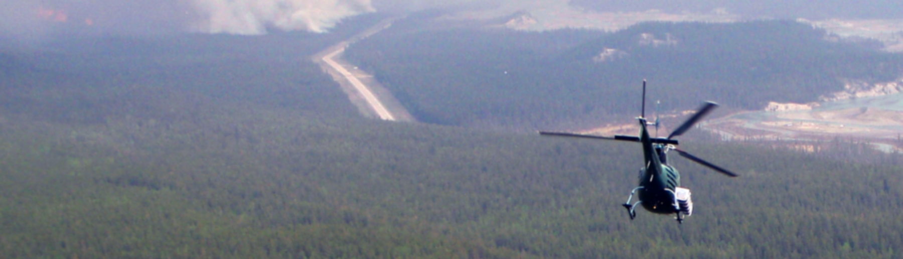


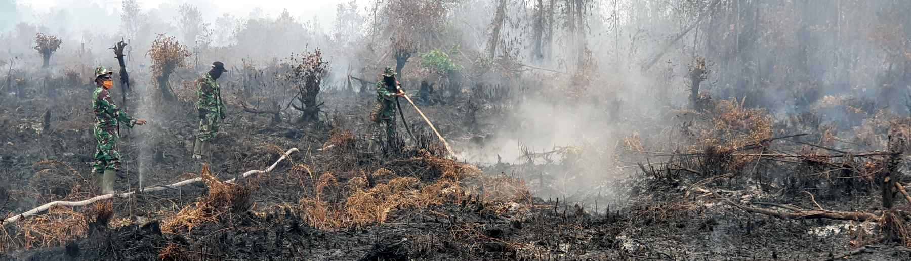

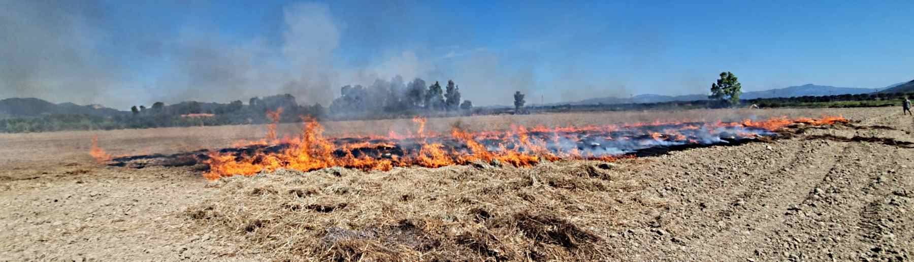

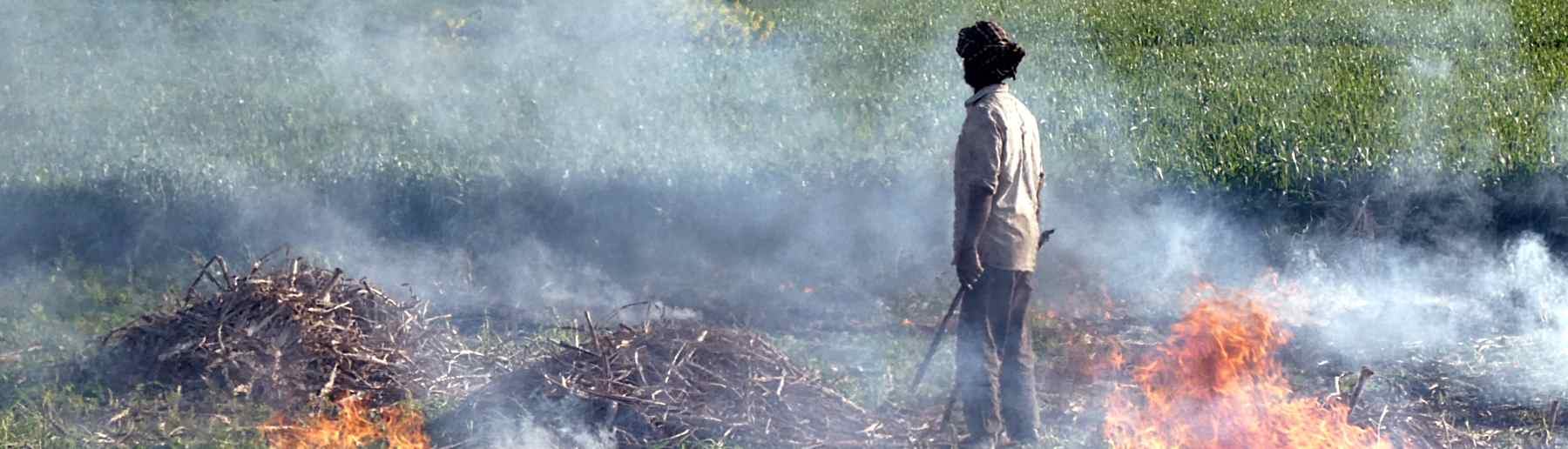
Our group support the development of a series of operational products based on satellite data feeds – most focused on the location and time of landscape fires, their Fire Radiative Power (FRP, in MWatts), and the rate at which fuel (vegetation and/or organic soil) is being consumed (Wooster et al., 2005) and that smoke is being released (Freeborn et al., 2008). Measuring FRP from space provides a way to estimate rates of release of smoke (and its constituent chemical compounds) to the atmosphere from the scale of individual fires to the whole globe. Integrating FRP over a a particulate time gives the total Fire Radiative Energy (FRE), which for wildfires should be approximately proportional to the total mass of fuel consumed and the total amount of any gaseous or particulate compound released.
Most such ‘active fire’ (AF) pixels will contain fires covering only a small minority, often less than 1%, of the pixel area. Once a pixel has been confirmed as containing an AF pixel then its FRP can be retrieved via analysis of its spectral signal elevation above that of background ‘non fire’ pixels. The fuel consumption and smoke emissions are then estimated from these FRP values, with the final information able to be delivered often within an hour of the data being collected.
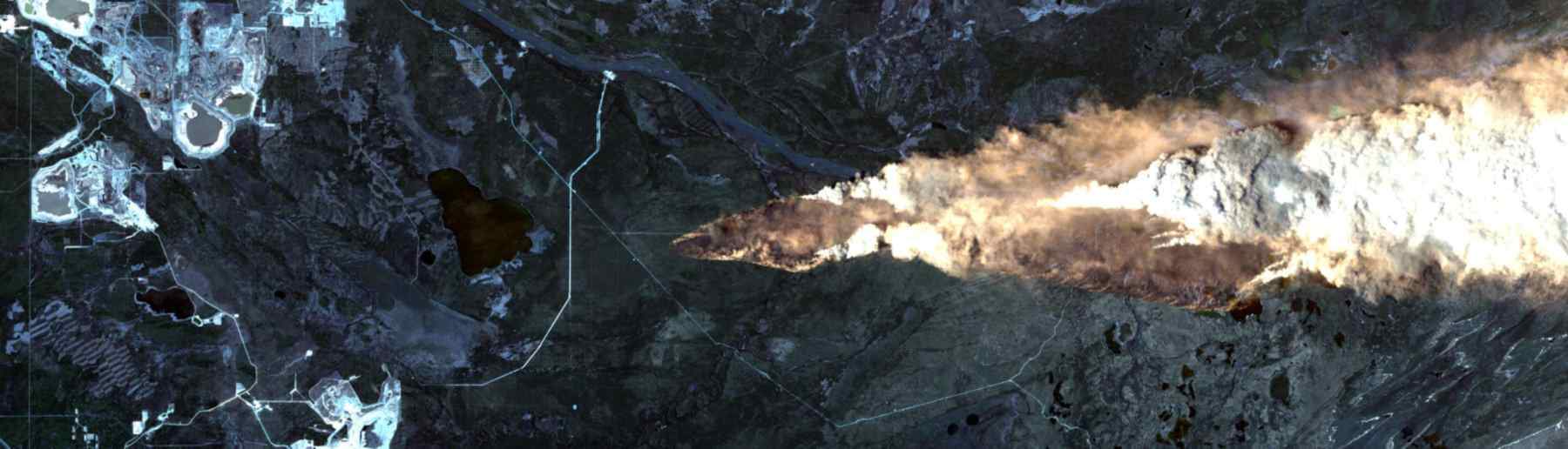
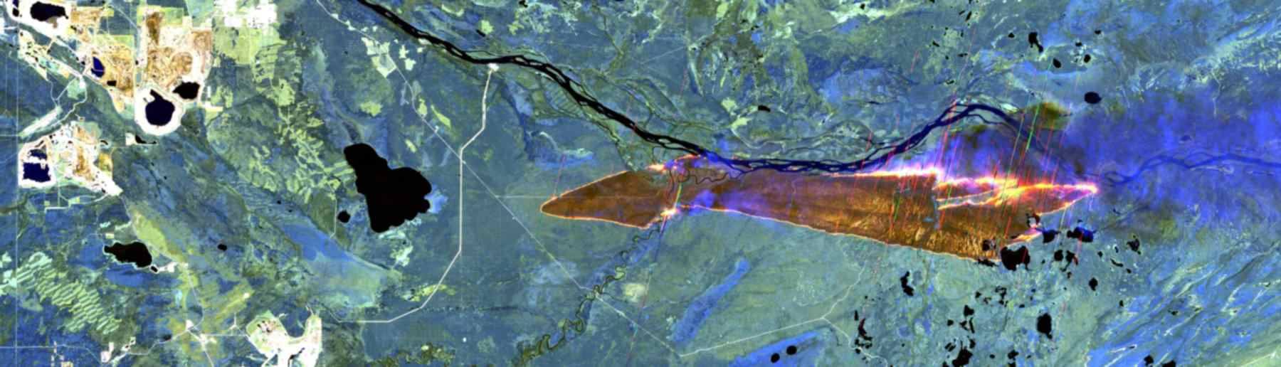
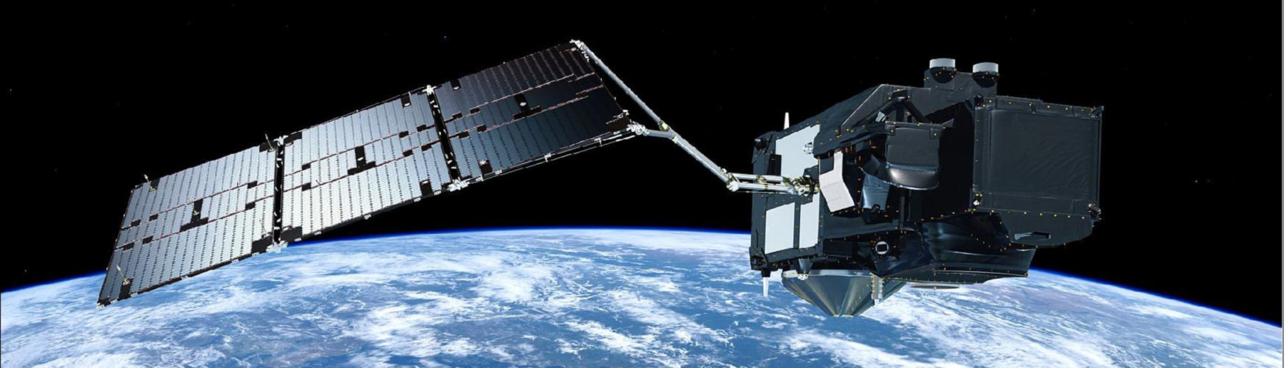
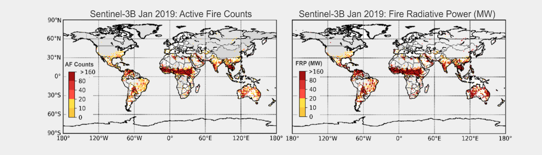
The Sentinel-3 mission is jointly operated by ESA and EUMETSAT to deliver operational ocean and land observation services, including information on landscape fires. Two Sentinel-3 satellites provide daily global data from near-polar, sun-synchronous orbits with a descending (ascending) node equatorial crossing at 10:00 hrs (22:00 hrs) Mean Local Solar time. Data from Sentinel-3’s Sea and Land Surface Temperature Radiometer (SLSTR) are used to generate a Level 2 Active Fire Detection and FRP product, based on the algorithm developed pre-launch by Wooster et al. (2012) and updated and optimised post launch Xu et al. (2020).
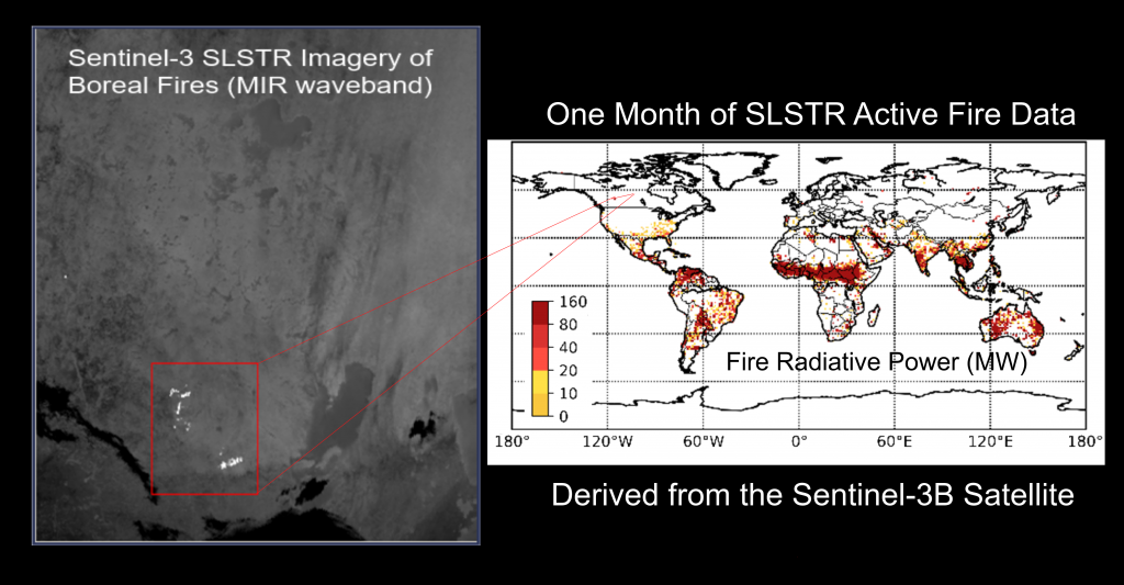
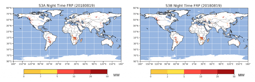
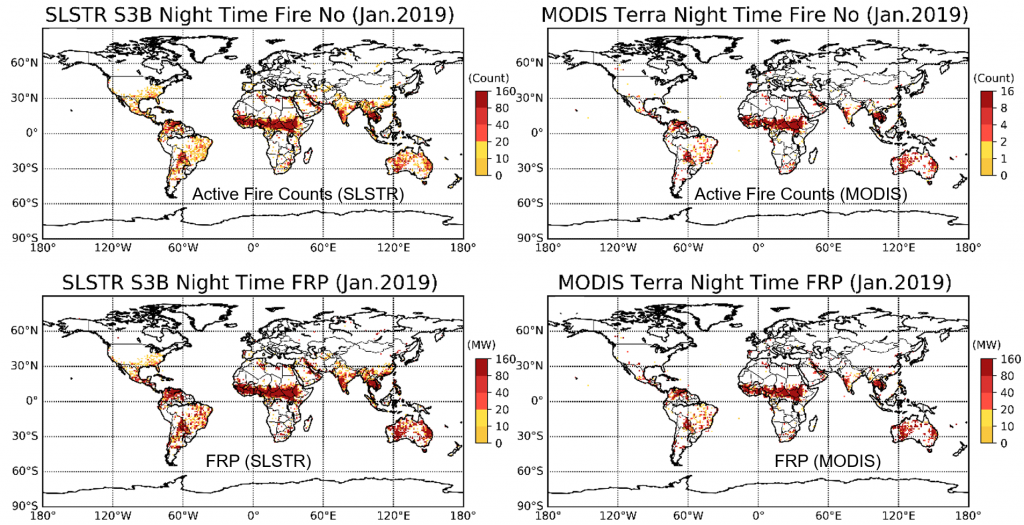
The information contained in the product is similar in nature to that of the MOD14 product derived from MODIS Terra observations made at a similar time of day. Currently the SLSTR data are mainly night-time only, and early evidence indicates that when SLSTR and MODIS Terra AF products are produced for the same area near simultaneously, the SLSTR product tends to detect more active fire pixels but a similar FRP since the extra detections are almost all low FRP fires (Xu et al., 2020). A full daytime Sentinel-3 product will be available in 2021.
The Sentinel-3 FRP product is available in two forms:
– Near real-time from EUMETSAT. See the latest daily global maps, along with full access information.
– Non-time critical (up to a few days delay; but now using the most accurate input data) via the Copernicus Open Data Hub, with full product information from ESA.
The NTC product is a Sentinel-3 Level 2 product (SL_2_FRP), with each product generated from 3-minute data granule. Each FRP product granule consists of an XML manifest (xfdumanifest.xml) and a set of eleven measurement and annotation data files in NetCDF-4 format containing:
– LIST dataset that is relatively small and provides information only at pixels classed as actively burning fires. Each parameter is stored as a 1D array of data, representing its value for each detected AF pixel.
– SUMMARY FLAG dataset which is larger but provides information on every granule pixel in the granule, related primarily to the output of the active fire detection tests and stored as a 2D array bit mask.
Many users will only require the information contained in the LIST dataset, and a full list of the parameters stored appears under the folder Metadata when the FRP product xfdumanifest.xml manifest file is opened in the free SNAP toolbox. Code written in e.g. Python or tools such as Panoply can also be used to view and manipulate these data.
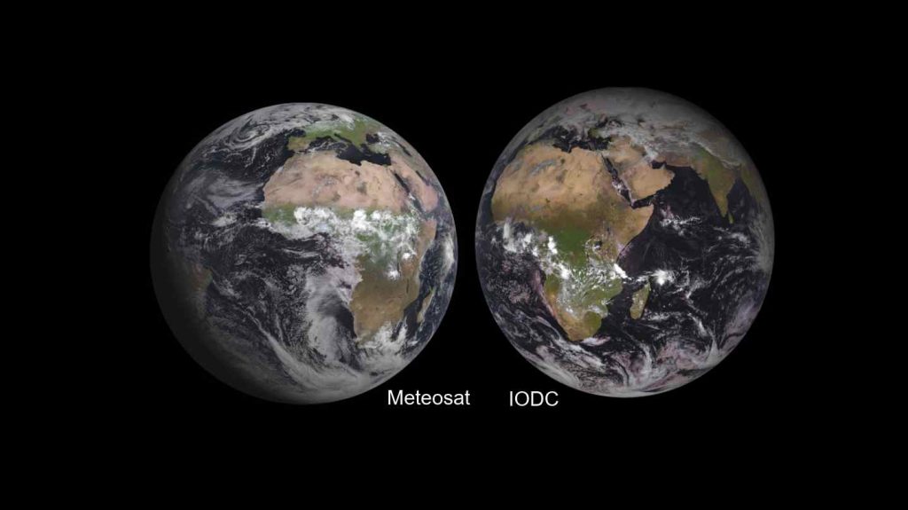
The geostationary FRP products the Group are responsible fore are delivered using an operational version of the Fire Thermal Anomaly (FTA) algorithm originally described in Roberts and Wooster (2008) and the MIR radiance method of FRP retrieval described in Wooster et al. (2003) and Wooster et al. (2005). Some enhancements and adjustments to these methods were developed over time, including those required to cope with the requirements of an operational production chain. The final operational algorithm is fully described in Wooster et al. (2015) and its application to Meteosat evaluated in Roberts et al. (2015). The Meteosat product (termed the Meteosat SEVIRI FRP-PIXEL product) is generated every 15 mins at the EUMETSAT Land Surface Analysis Satellite Application Facility (LSA SAF), and a full product user manual can be found here. There is also a matching Meteosat IODC FRP-Pixel Product generated from the Meteosat positioned over the Indian Ocean.
Details on how these data maybe obtained, including close to real-time, is available from the LSA SAF, and an archive of the primary Meteosat product exists back to 2004. As with the SLSTR FRP products described above, the FRP-PIXEL Product consists of both a LIST file providing data at active fire pixels only, and a larger Quality Product (SUMMARY FLAG) providing information at all SEVIRI pixels. A gridded FRP-GRID product from both systems delivered at lower spatial and temporal resolution but with statistical adjustments made for cloud cover and for low FRP fires unable to be detected by SEVIRI is also available.
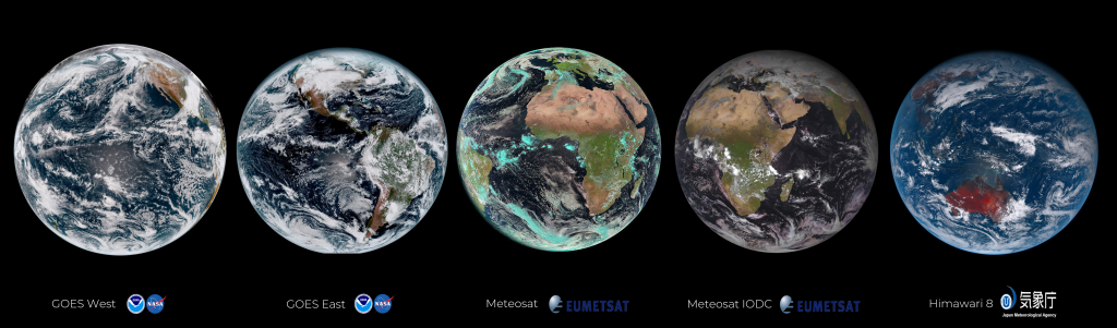
Further geostationary FRP products are produced from the GOES-R systems (now operating as GOES-E and GOES-W over the America’s) and from Himawari over Asia. These data are available in near real time at the full resolution of the instruments (every 10 minutes for GOES-R and Himawari). Contact martin.wooster@kcl.ac.uk to discuss access to these data. Currently the FTA algorithm is being adapted for use for Meteosat Third Generation, which will provide a significant advance on Meteosat SEVIRI after its launch in ~ 2022.
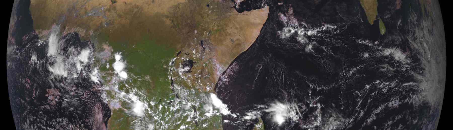
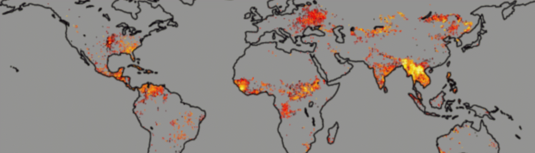
The global fire assimilation system (GFAS) provides one of the essential inputs to the Copernicus Atmosphere Monitoring Service (CAMS). Currently King’s lead the GFAS development project enabling new polar-orbiting and geostationary satellite FRP data streams to be tested within a future iteration of the operational GFAS, and developing and trialing new features aimed at improving the temporal frequency, accuracy and independence from other fire emissions inventories. Operated at ECMWF (The European Center for Medium-Range Weather Forecasts), GFAS delivers near-real-time estimates of landscape fire emissions – both trace gases and aerosols – using satellite FRP observations derived from observations of actively burning fires.
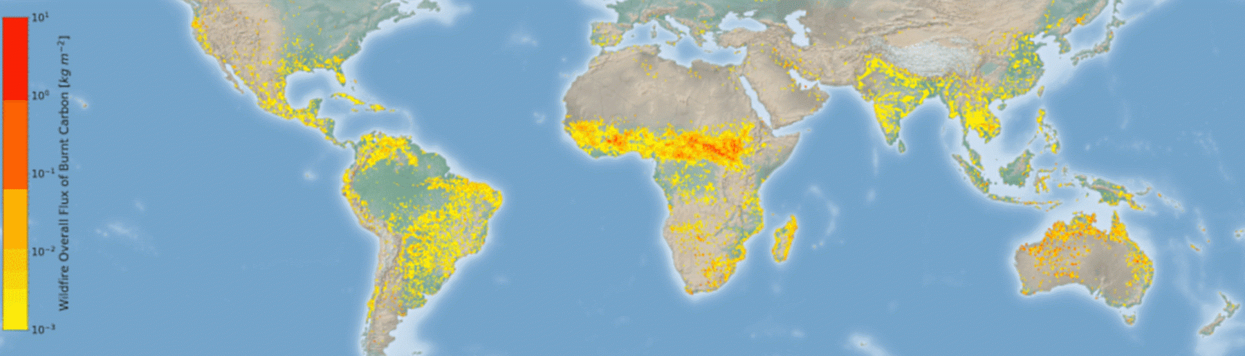
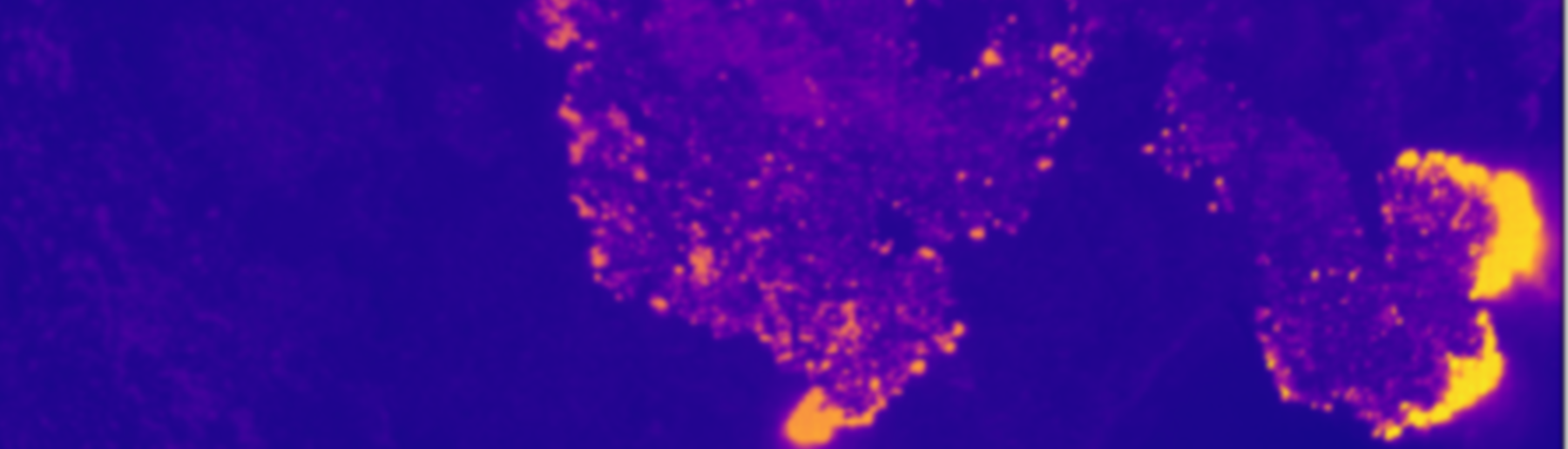
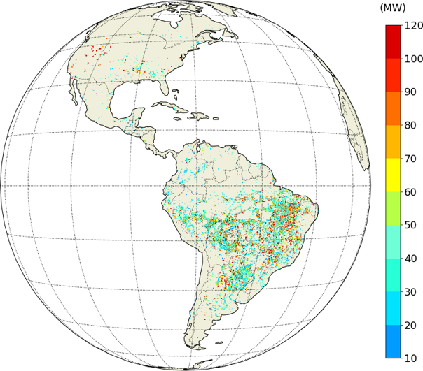
At the location of each active fire detection the FRP of the sub-pixel fires can be estimated. Data from different overpasses and also different satellites can be blended together to produce global FRP maps generated every hour by GFAS. An example of this is shown below at a daily temporal resolution.
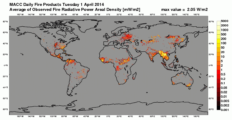
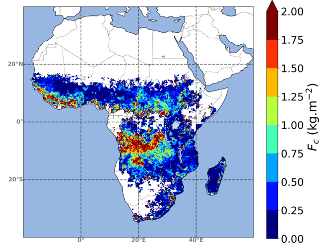
One the FRP observations are available within GFAS, they are converted to landscape fire emission estimates, covering more than 40 different compounds (e.g. carbon, CO2, CO, black carbon aerosol, organic carbon aerosol, total particulate matter, etc). The GFAS fire emissions themselves are also part of the CAMS product portfolio available here.
![]()
King’s College London, Bush House (NE wing), 30 Aldwych, London, WC2B 4BG