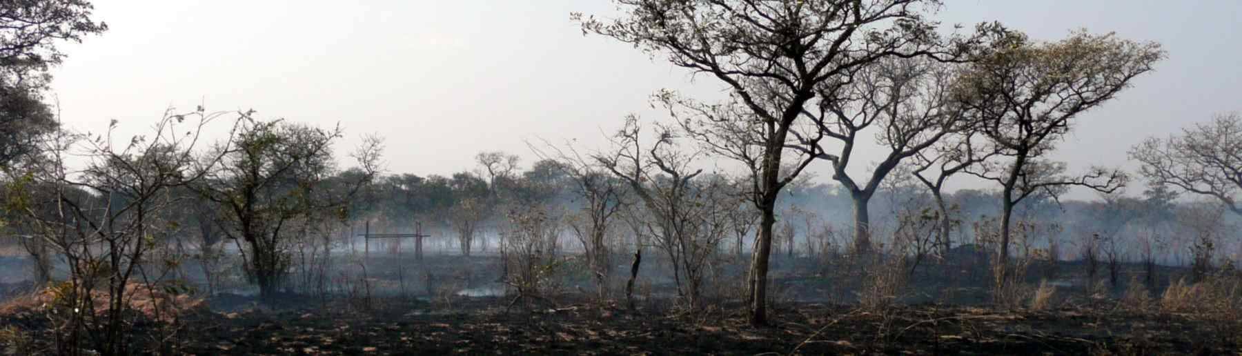


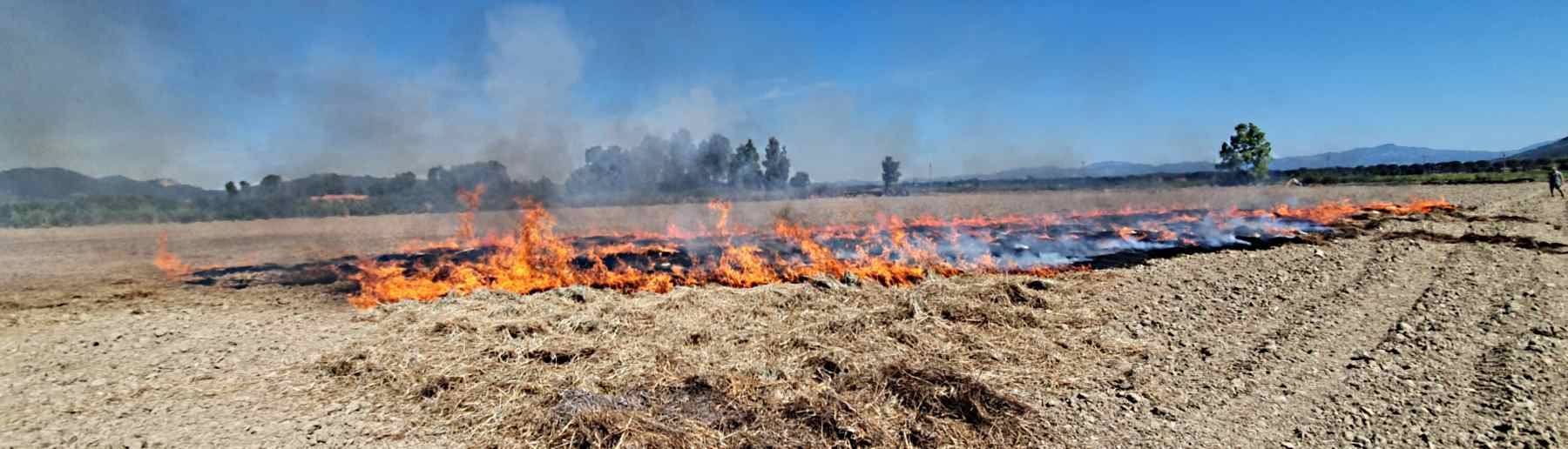
Landscape fires are common across much of the Earth, consuming huge amounts of vegetation and organic soil ‘fuel’ and releasing the products of this combustion into the atmosphere as smoke containing hundreds of different chemical compounds as both gases and particulates. Manifest in many forms, from extreme “megafires” in forests or peatlands to individually small but very numerous agricultural waste burns, landscape fire therefore has local to global-scale effects on both the land and the atmosphere, and understanding its extent and impact is important to many areas of Earth System Science.
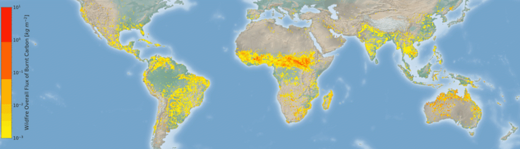
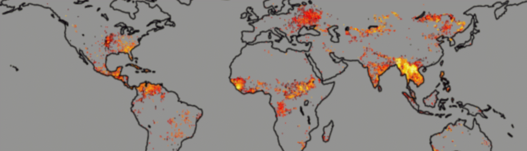
On average, global satellite data suggest that around 3.5 million km² of land burns every year, around the area of India, though this is likely to be a significant underestimate since current global mapping misses many of the hugely numerous smaller burns. Large and not easily predicted interannual variability exists in many places, making satellite EO data essential for the quantification of large-scale landscape fire activity, and to near real-time fire monitoring. We develop a series of satellite EO products that help to provide such monitoring, and contribute to the validation of these using our fieldwork capabilities, including in airborne Earth Observation.


Below are three links describing a few of our activities, along with further background information.
Much of our research on landscape fire is conducted in the context of the Leverhulme Center for Wildfires, Environment and Society, a major interdisciplinary research center funded for a decade by the Leverhulme Trust starting in 2019, and in our role as part of NERC’s National Center for Earth Observation. We also have many projects funded by external agencies, such as BBSRC, STFC, The Royal Society, European Space Agency (ESA) and EUMETSAT.
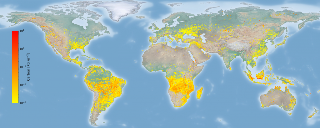
In terms of the significance of landscape fires, for some atmospheric species, such as the air pollutant carbon monoxide (CO), landscape fires are among the most dominant of global sources – but in fact smoke from fires contains over a hundred different chemical compounds. Carbon dioxide is by far the most prevalent, and fire converts the ~ 50% of plant material that is carbon into mostly this greenhouse gas. When landscape fire burns peat or is involved in land cover change, such as in areas of permanent deforestation, the carbon released represents a net transfer from the land to the atmosphere. Such activities are believed to be responsible for perhaps around 15% of the current atmospheric carbon dioxide growth rate driving climate change. Aerosols in the form of fine particulate matter are another major component of landscape fire smoke and also have effects on Earth’s radiation balance that are important for climate change, and they are also the component of landscape fire smoke that have the greatest impact on air quality and human health.

Landscape fire is certainly not a whole negative phenomena however. In fact, fire is essential to the current functioning and health of many ecosystems, helping to renew vegetation stands, create ecological niches, and re-cycle carbon and other elements in Earth’s biosphere. But in certain places it poses a direct risk to infrastructure and lives, and in terms of the latter this includes via its sometimes serious impact on the quality of the air we breathe. Our group specialises in using remote sensing from satellites, from aircraft and from the ground, supplemented by additional measurements both in the laboratory and in the field – to better understand and quantify landscape fire and its effects.
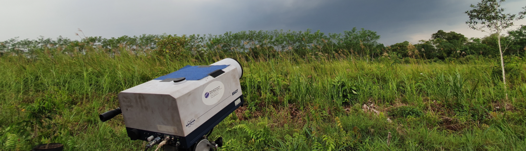
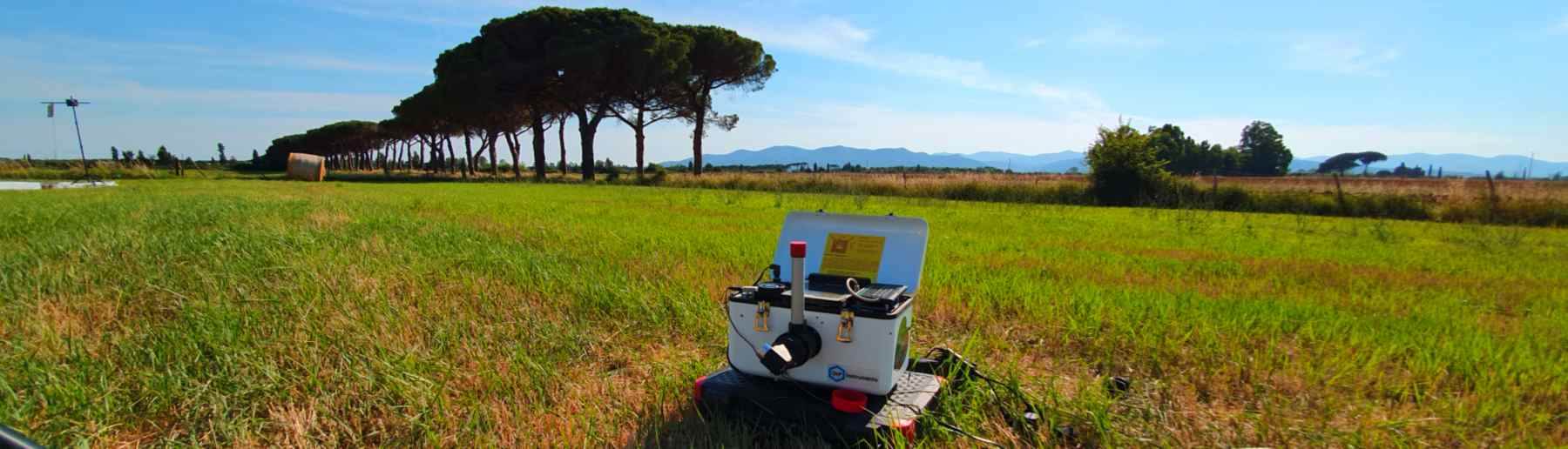
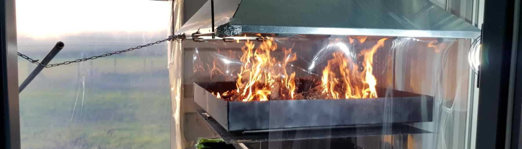
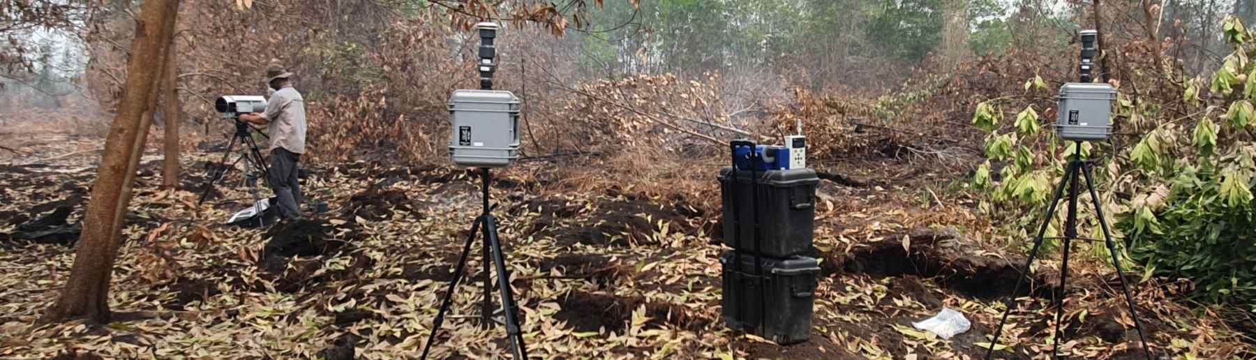
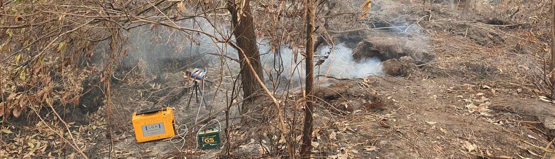
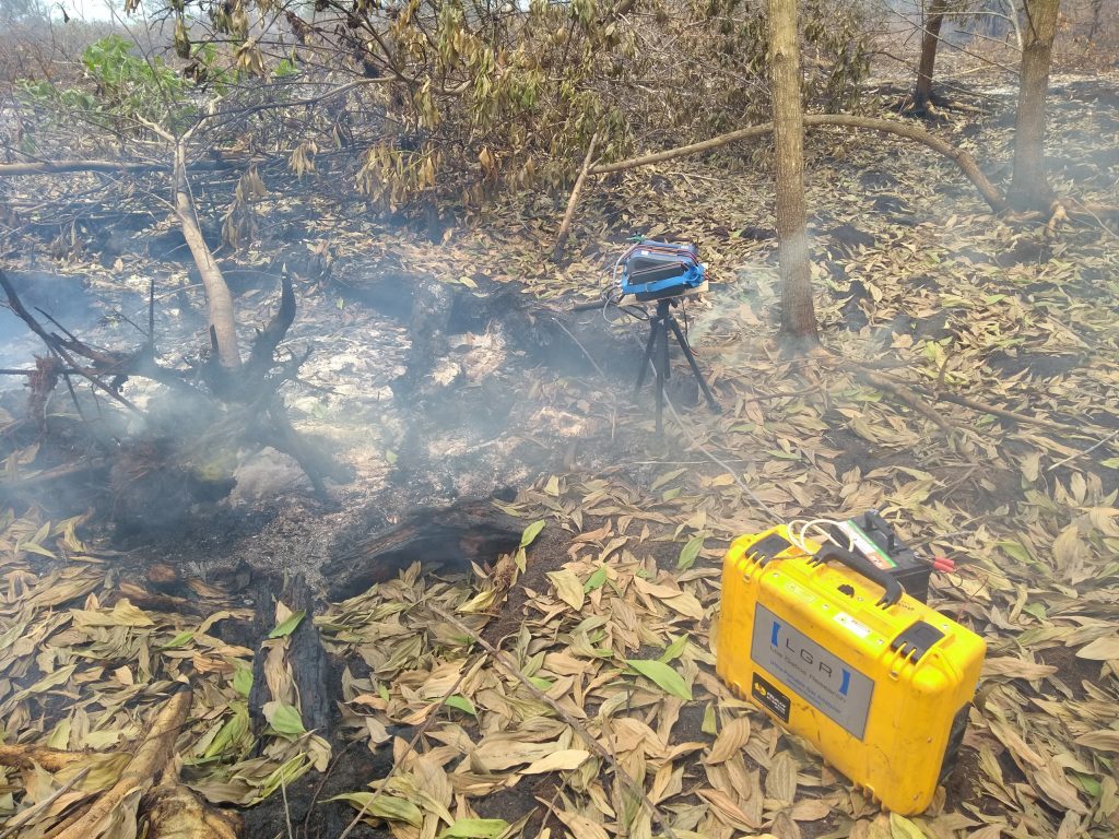
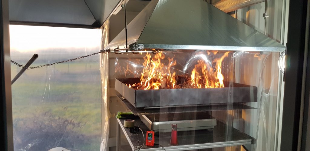
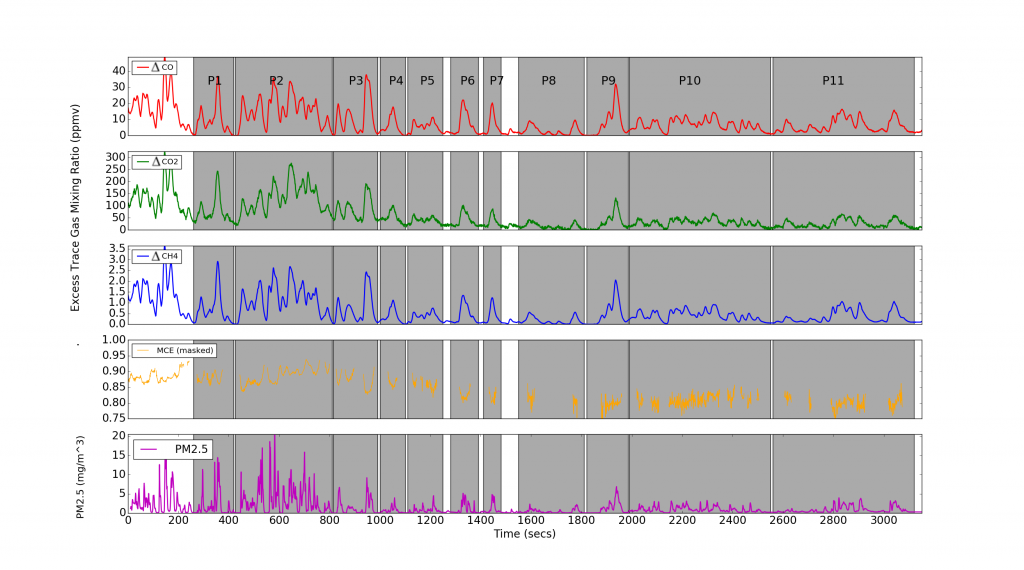
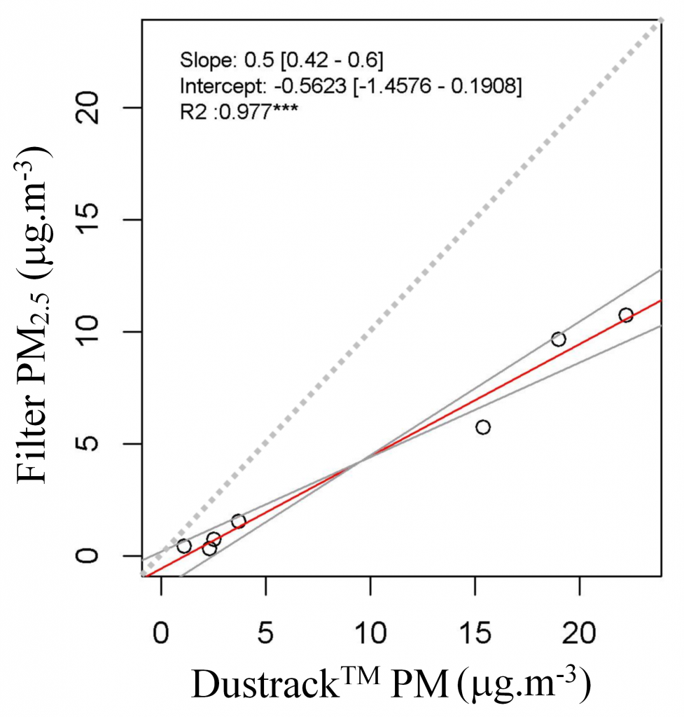
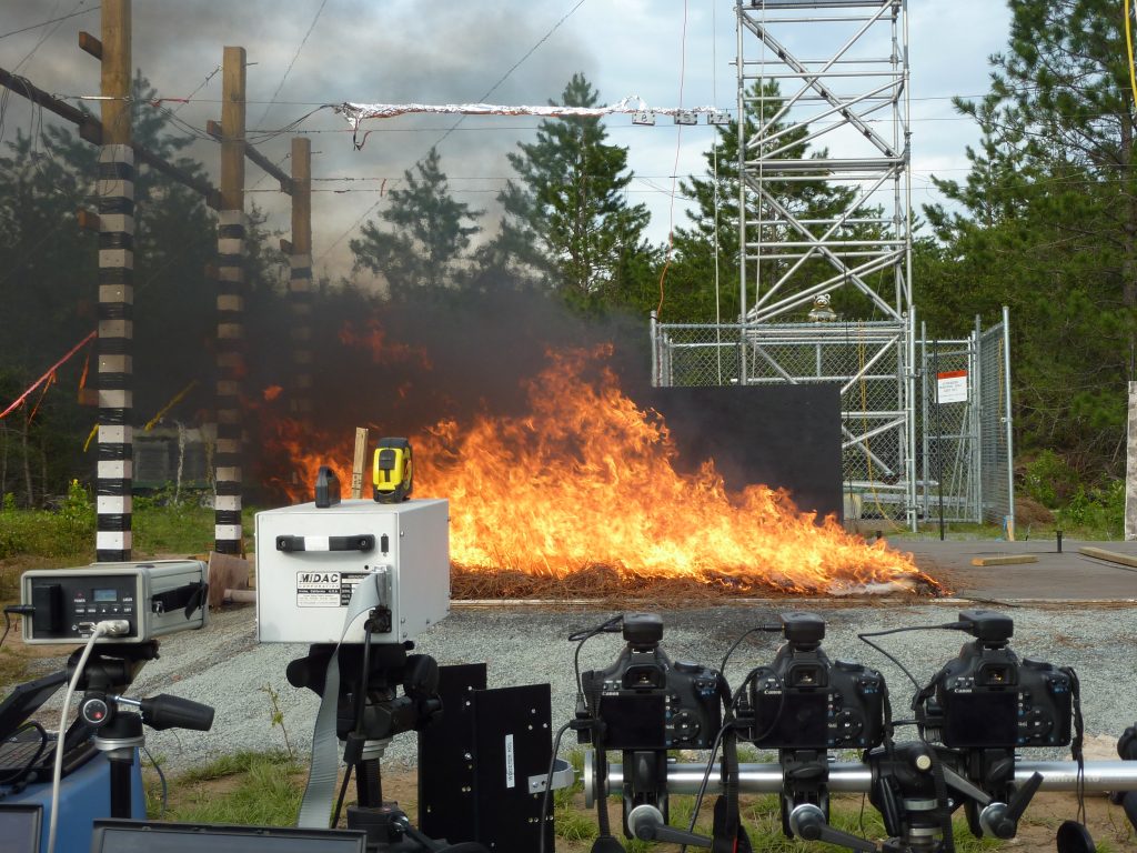
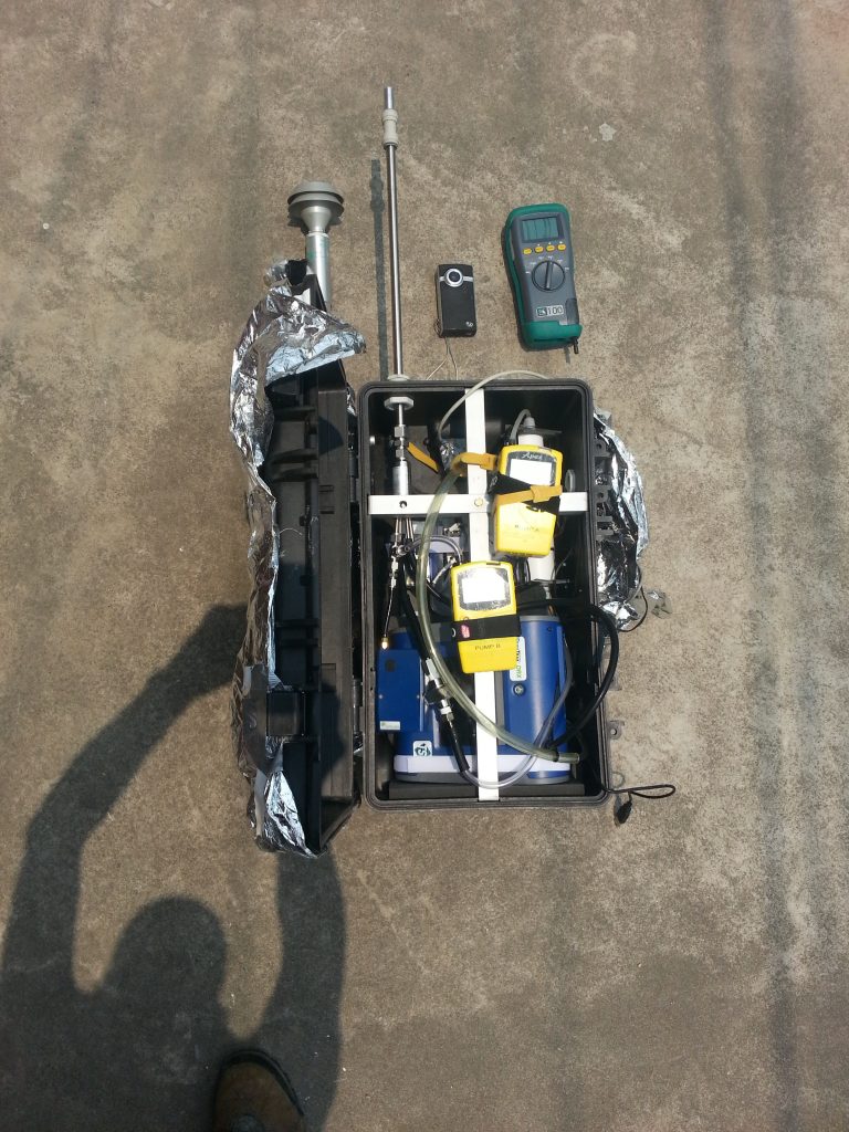
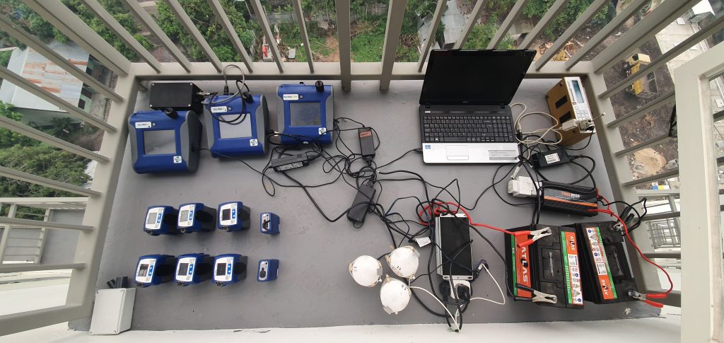
Smoke from landscape fires is a complex mix of gases and particulate aerosols, and each emitted species is characterised by an ‘Emission factor’ (EF) that represents the amount (g) released per kg of vegetation or organic soil burned. EFs are dependent on the type of fuel being burned, and very likely also on its condition (e.g. moisture content) and the type of fire consuming it (e.g. smoldering or flaming). We are use both field measurements and the controlled conditions of our Wildfire Testing Chamber to study EFs of different fires. Gaseous components of the smoke are mainly analysed using infrared spectroscopy, whilst particulates are characterised using various techniques including filter sampling and laser-based backscattering systems. These data are then combined with estimates of fuel consumption based typically on satellite data to estimate overall fire emissions totals. Using the Fire Radiative Power (FRP) method this can be done in real-time based on satellite active fire detections, for example within the Global Fire Assimilation System (GFAS).
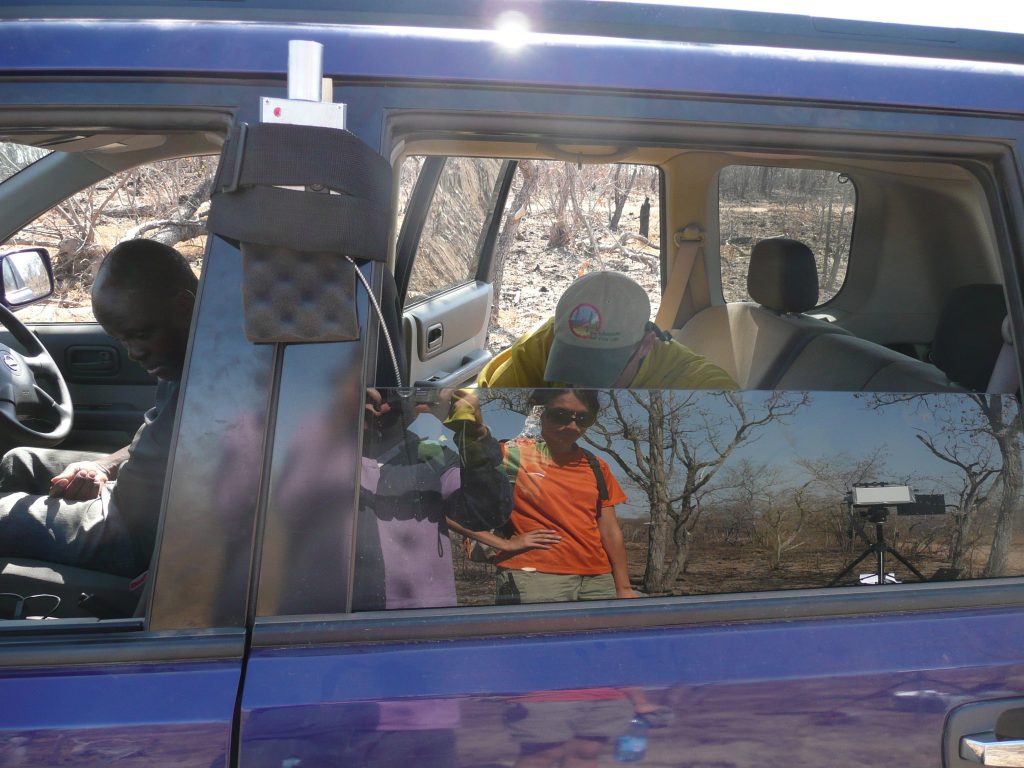
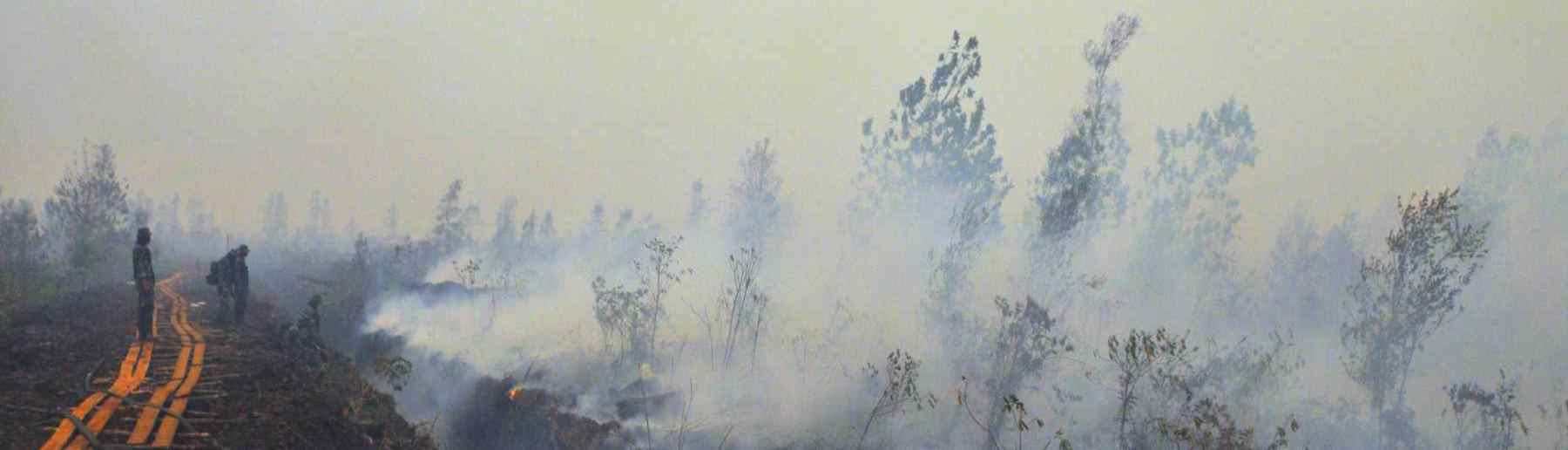
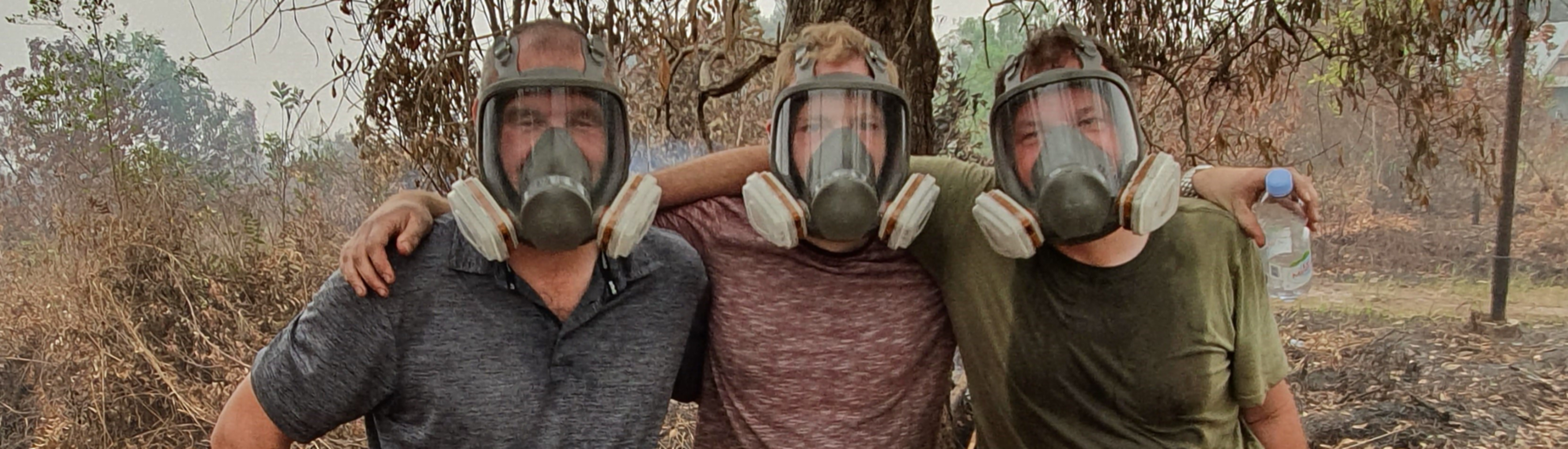
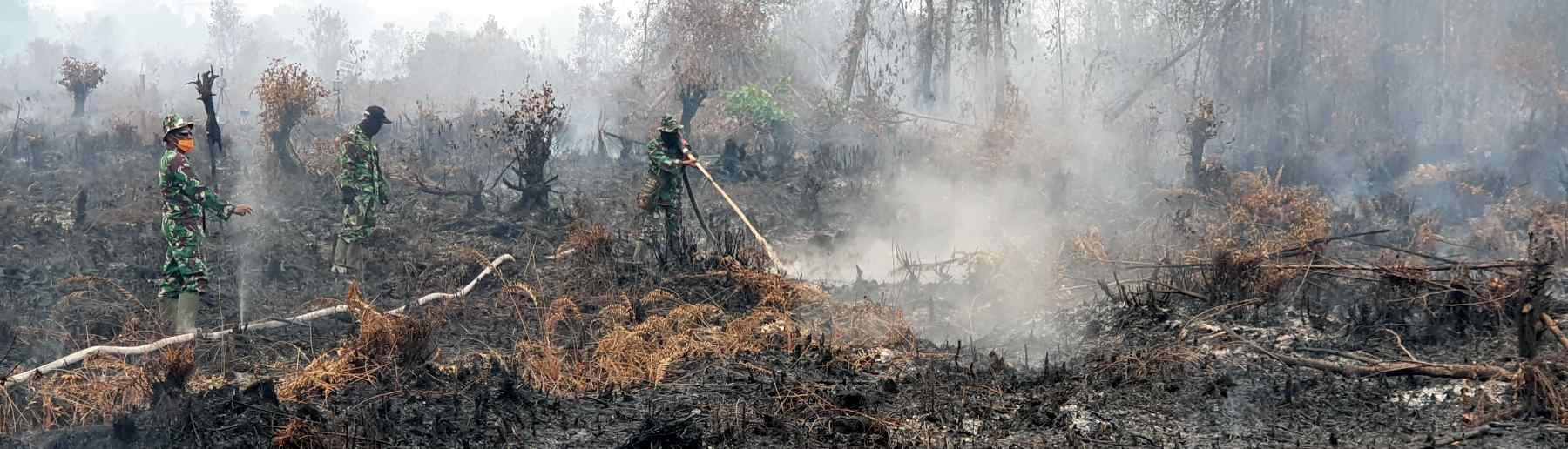
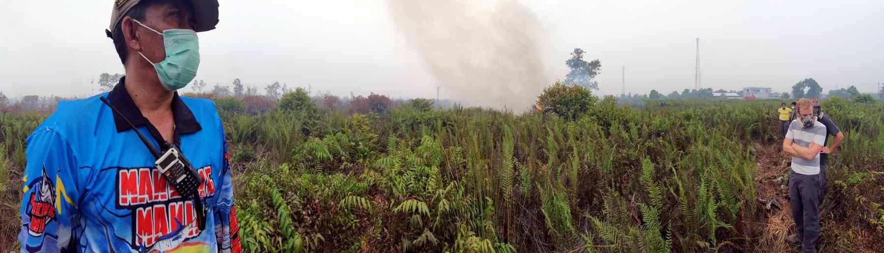
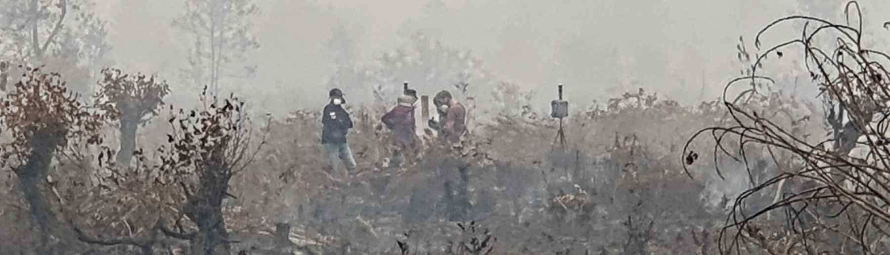
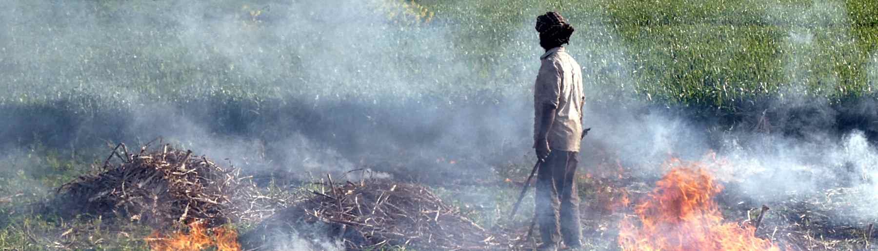
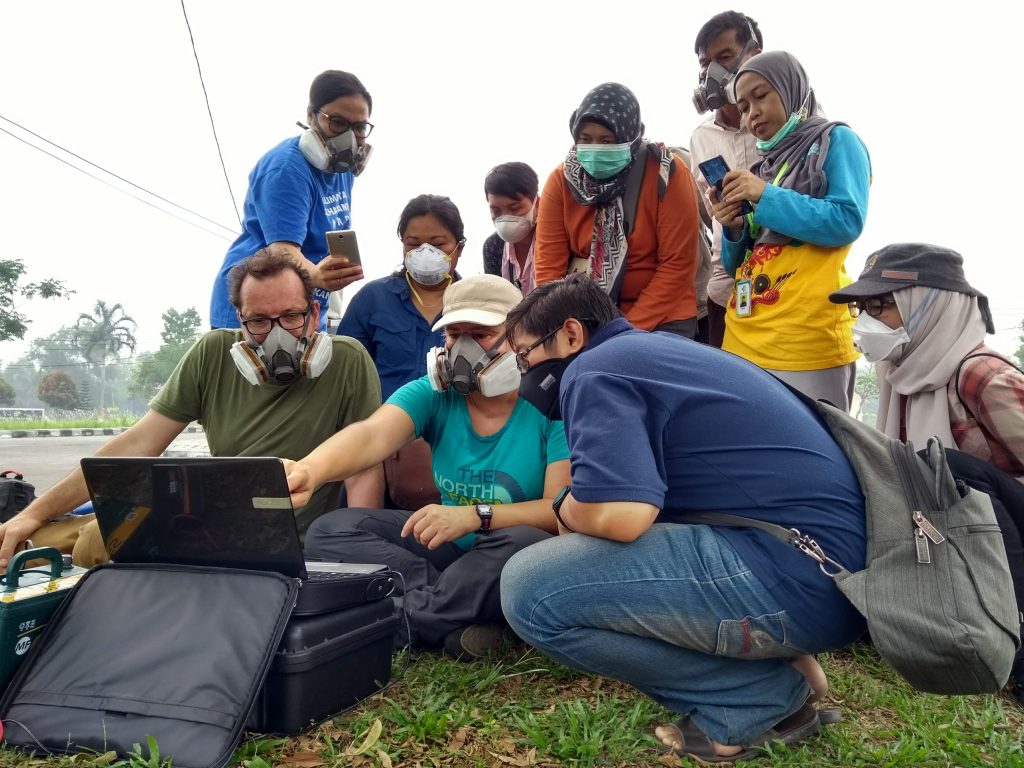
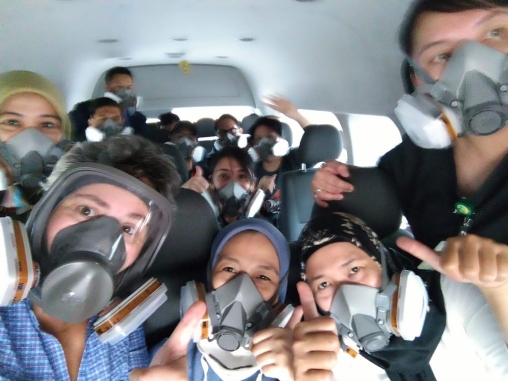
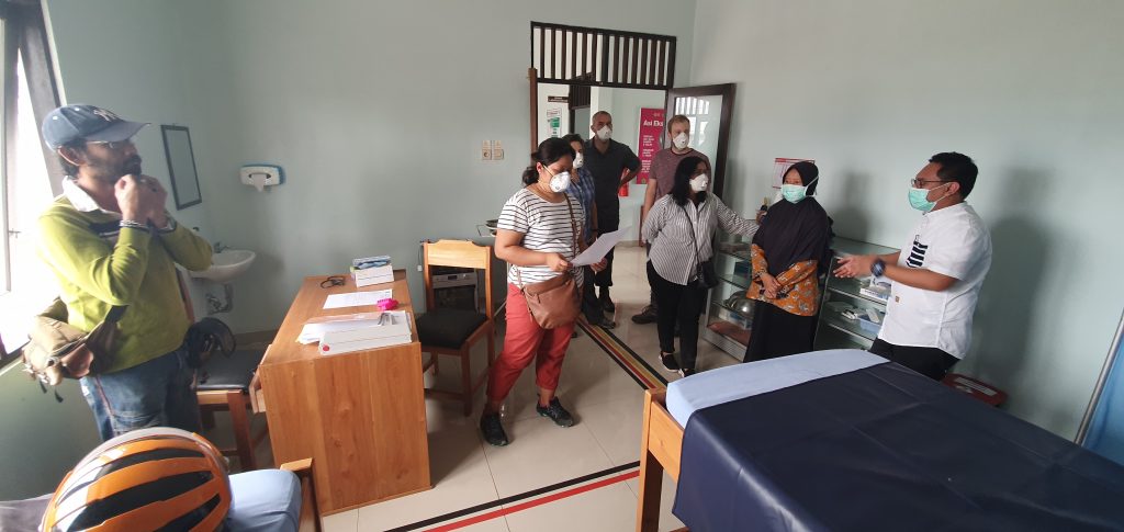
Indonesia hosts more than one third of the world’s total topical peat, and decades of forest clearance and peatland drainage has resulted in many of these landscapes becoming far drier and more flammable than their natural state. During dry periods the carbon rich soil itself can be ignited by fires commonly used in the region to help manage agriculture, to burn trash, or as a tool in land disputes. Sumatra and Kalimantan are the most affected locations, and August to October is Central Kalimantan’s annual fire season, which becomes most extreme during El Niño related droughts. During the most recent ‘mega fire’ events (2015, 2019) we travelled Kalimantan, to work with local NGOs, government and academics to study the fires and their effects and participate in knowledge exchange workshops. New gaseous emissions factors (EFs) derived from our 2015 fieldwork were combined with satellite data and atmospheric modelling to produce the first estimate of GHG and carbon release from these extreme SE Asian fires – which showed them to be the largest since the record breaking El Niño of 1997 and exceeding for example all CO2 emissions coming from the European Union over the same period. We subsequently found the fires also responsible for what was then the world’s worst air quality due to their huge consumption of fuel and their very high EFs of fine particulate matter (PM2.5). PM2.5 is the most health impacting smoke component, yet many local buildings provide little protection, and in 2019 we helped install a new PM sensor network in Central Kalimantan to assess citizens exposure to harmful air and support ongoing studies into the fires health effects. We are also working on the development of new top-down, satellite based, approaches for PM emissions estimation to improve predictions on the regional distribution of these pollutants during El Niño episodes.

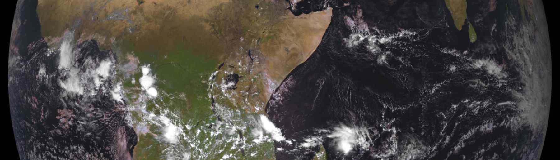
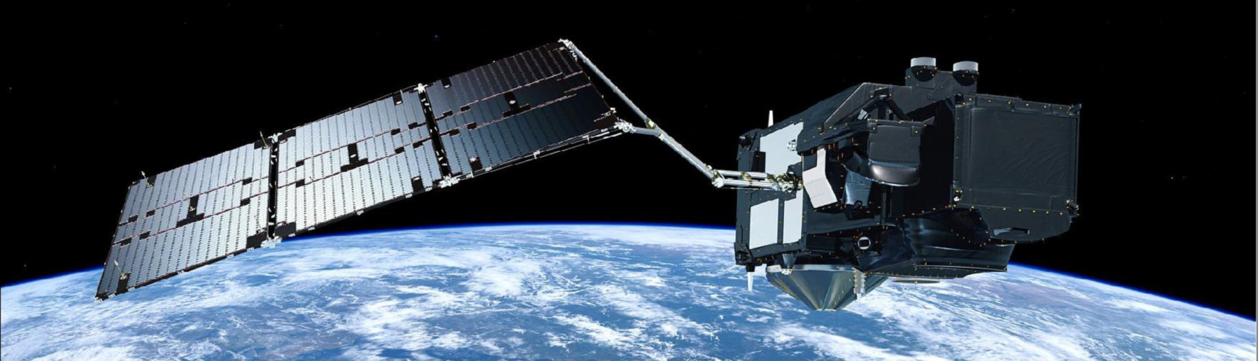
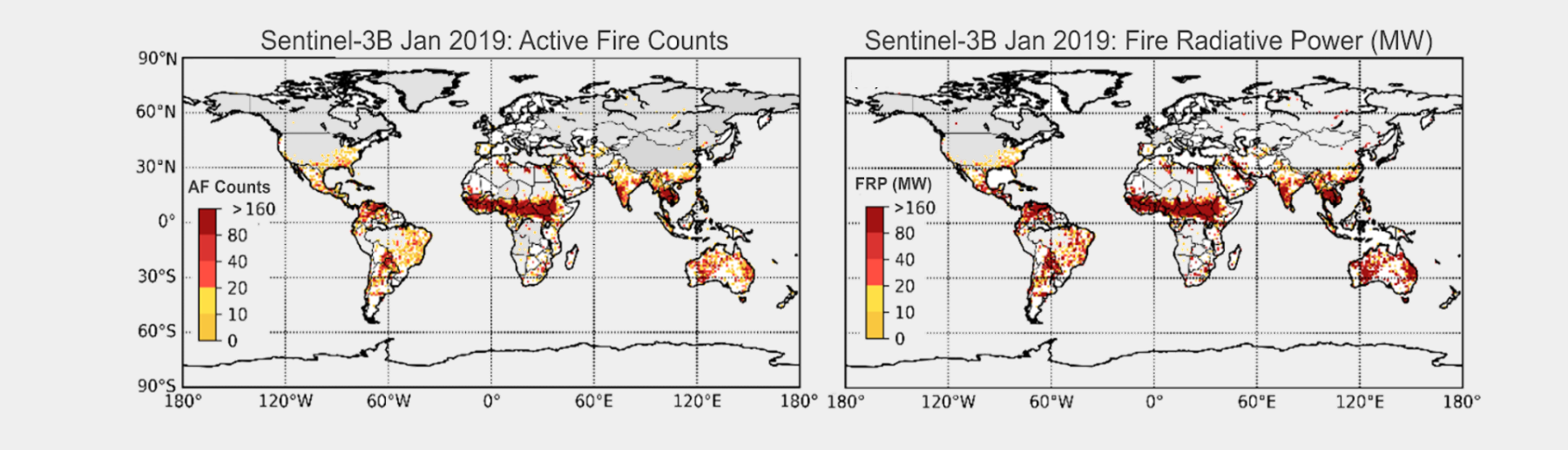
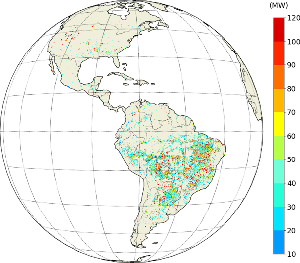
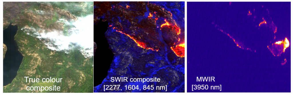
Earth Observation (EO) satellites provide the only globally consistent and very frequently updated information on landscape fires available worldwide. The method we focus upon is based on identification and analysis of actively burning fires using thermal detection techniques, since this ‘Fire Radiative Power’ (FRP) approach is capable of providing real-time information on fires anywhere on the planet whilst they are still burning, and also tends to minimise the need for additional modelling or assumptions when turning the basic satellite-derived information (the radiative heat output of the fire in MegaWatts) into estimates of the amount of fuel (vegetation and organic soil) being consumed, and the amount of smoke being released to the atmosphere.
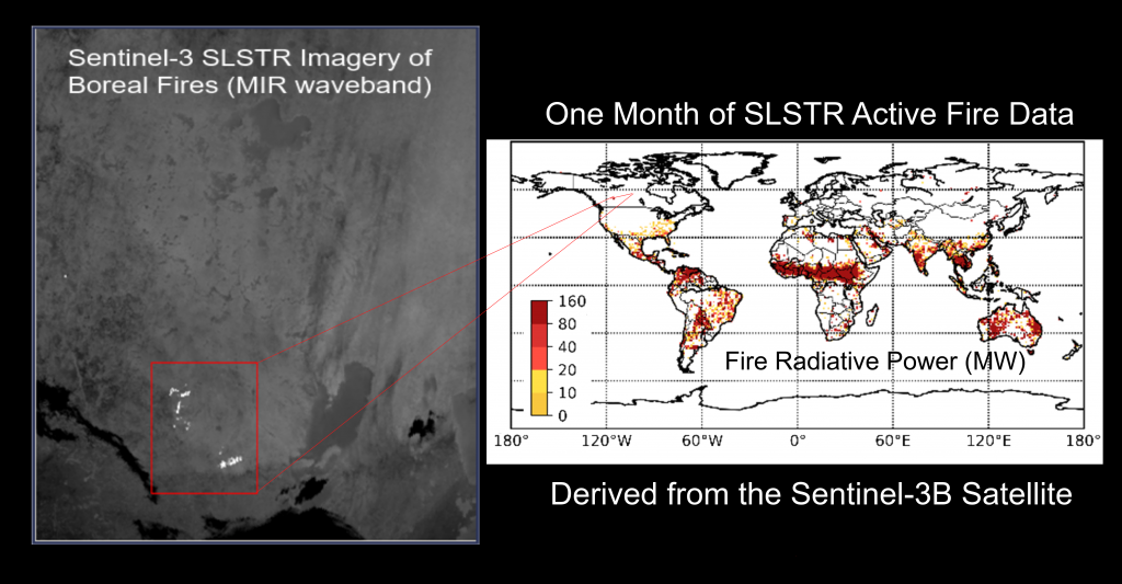
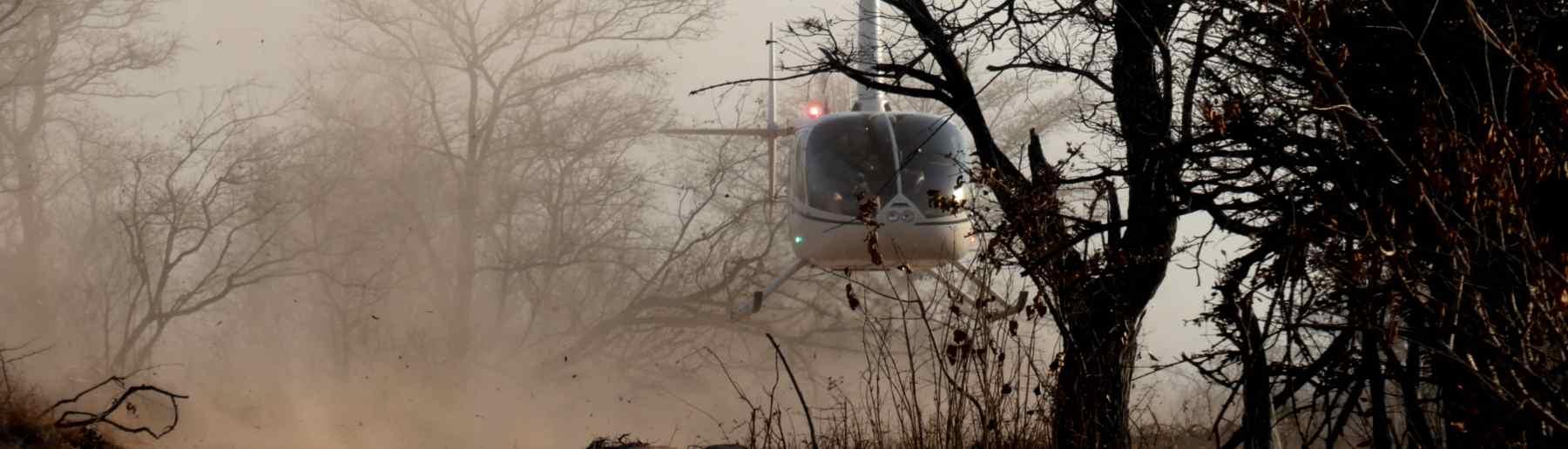
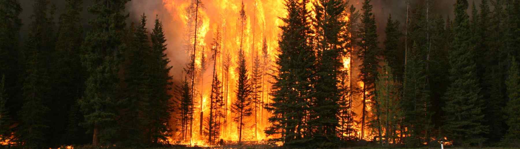
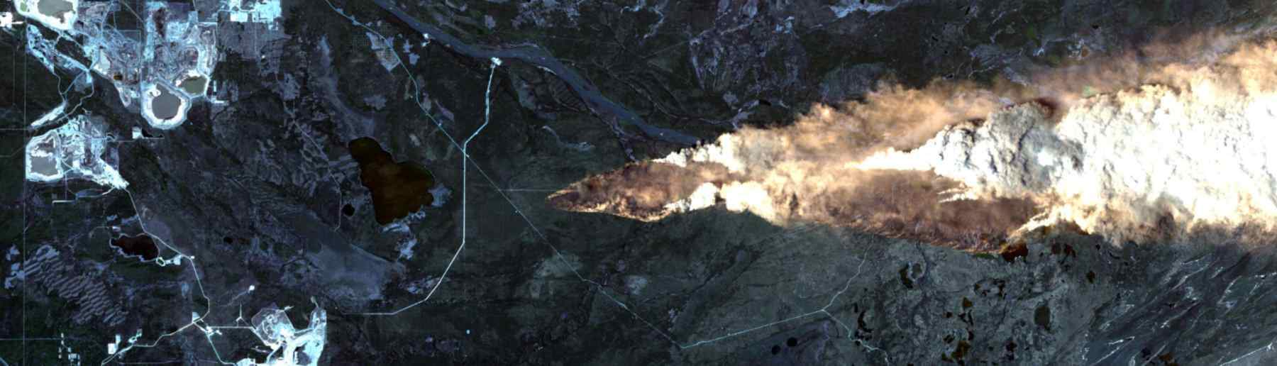
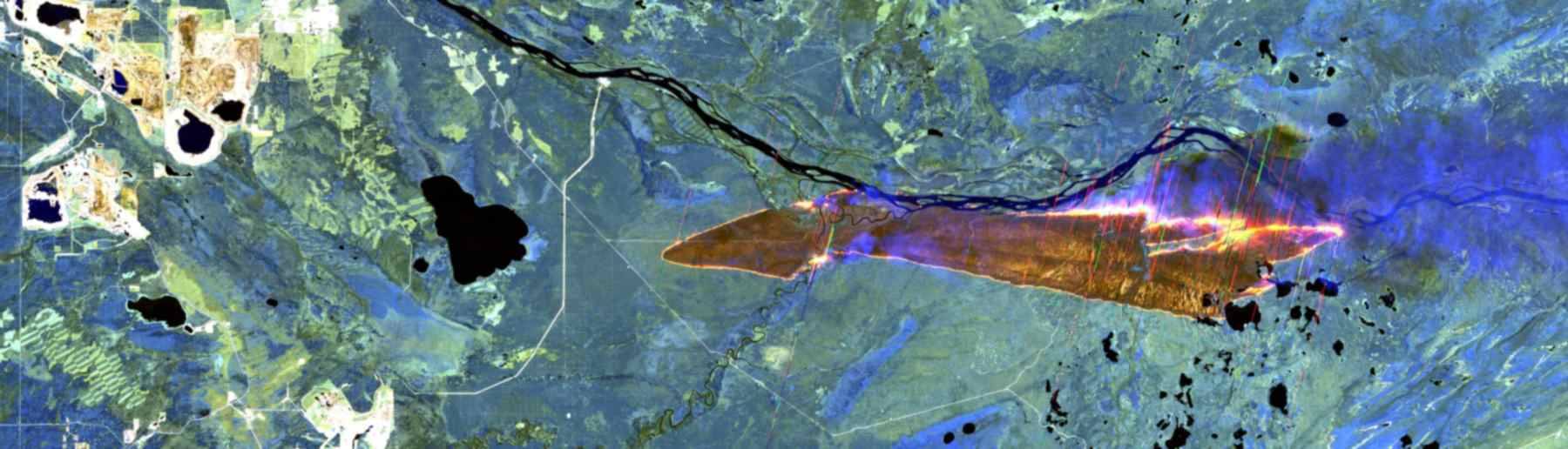
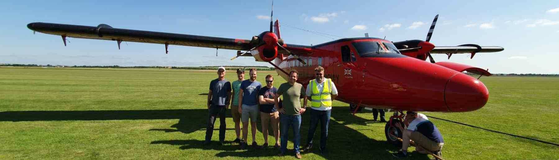
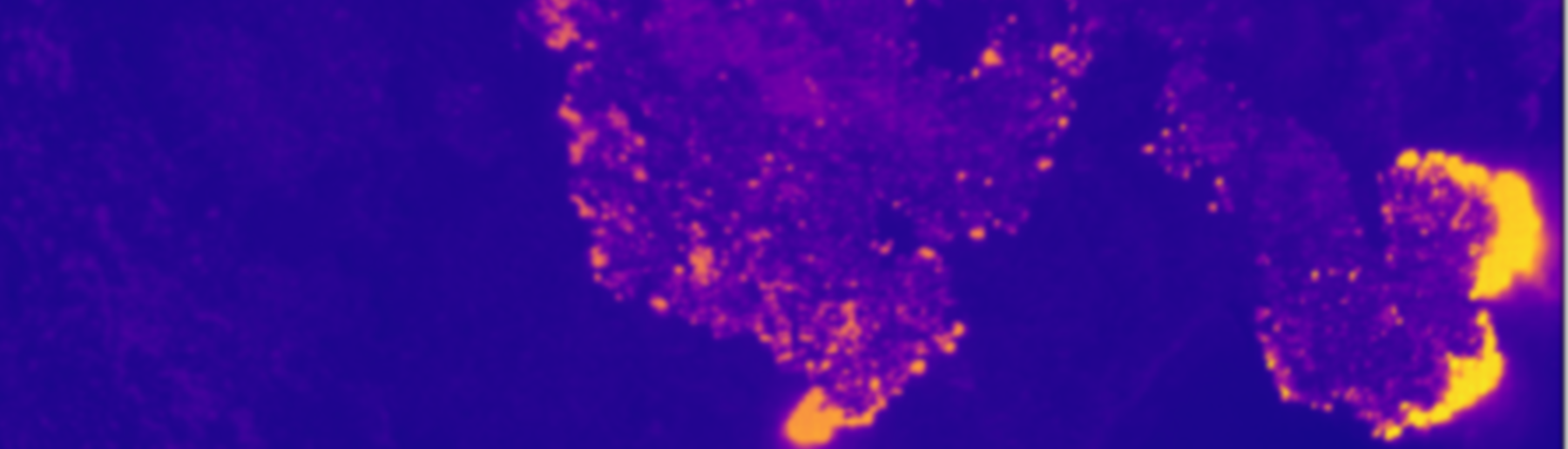
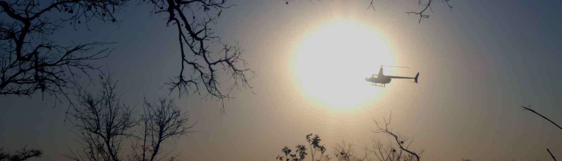
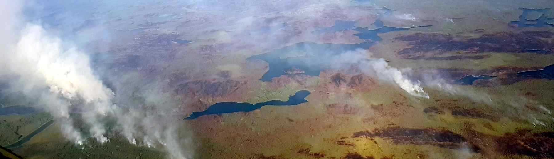
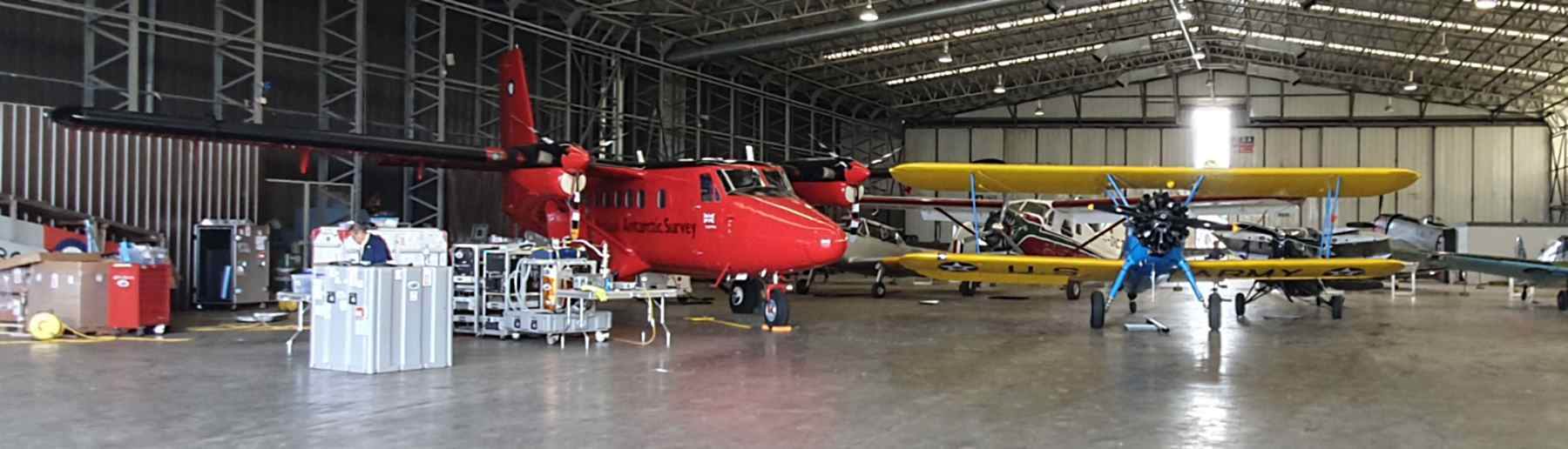
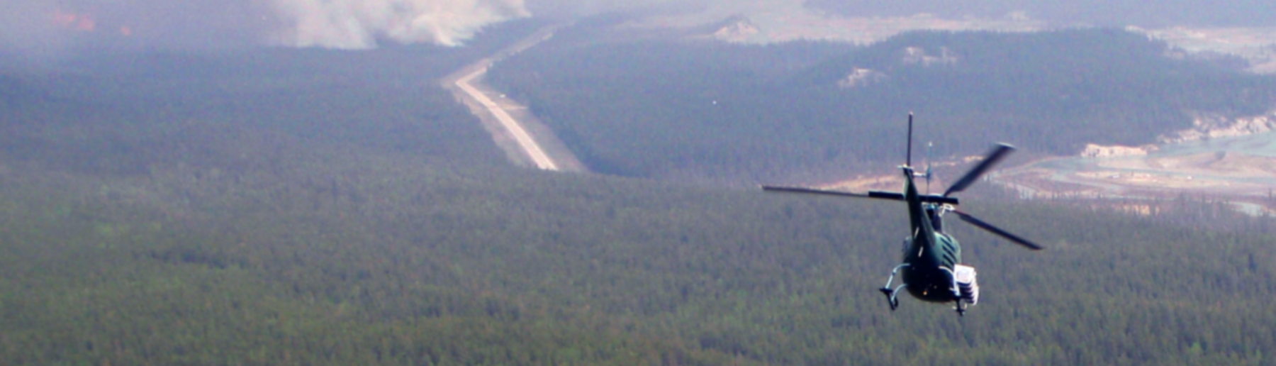
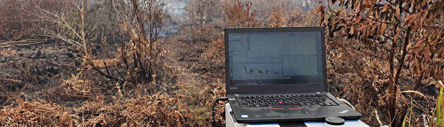
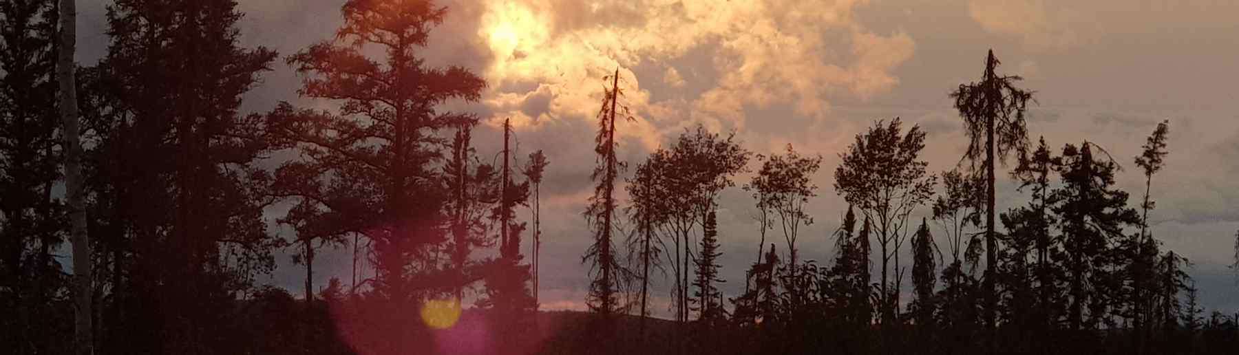
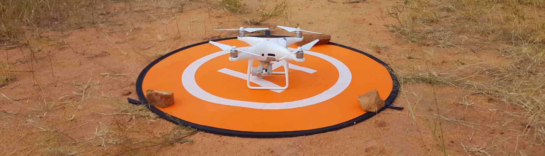
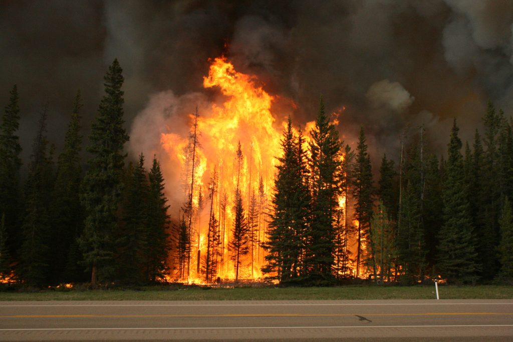
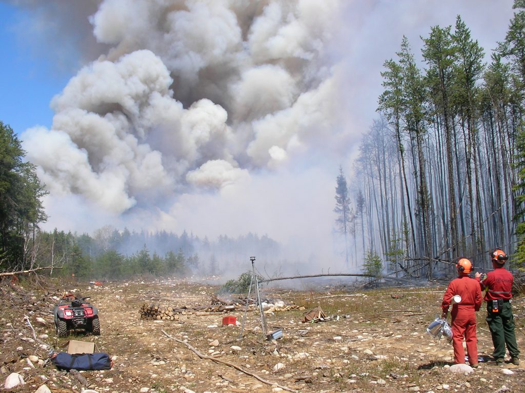
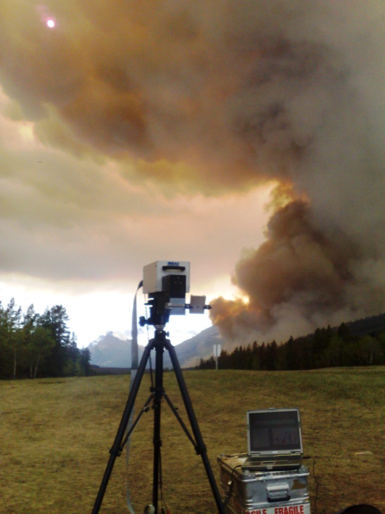
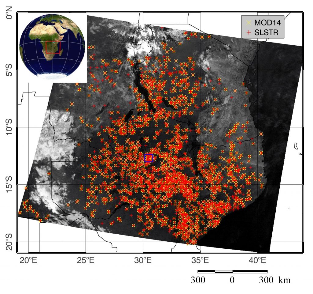
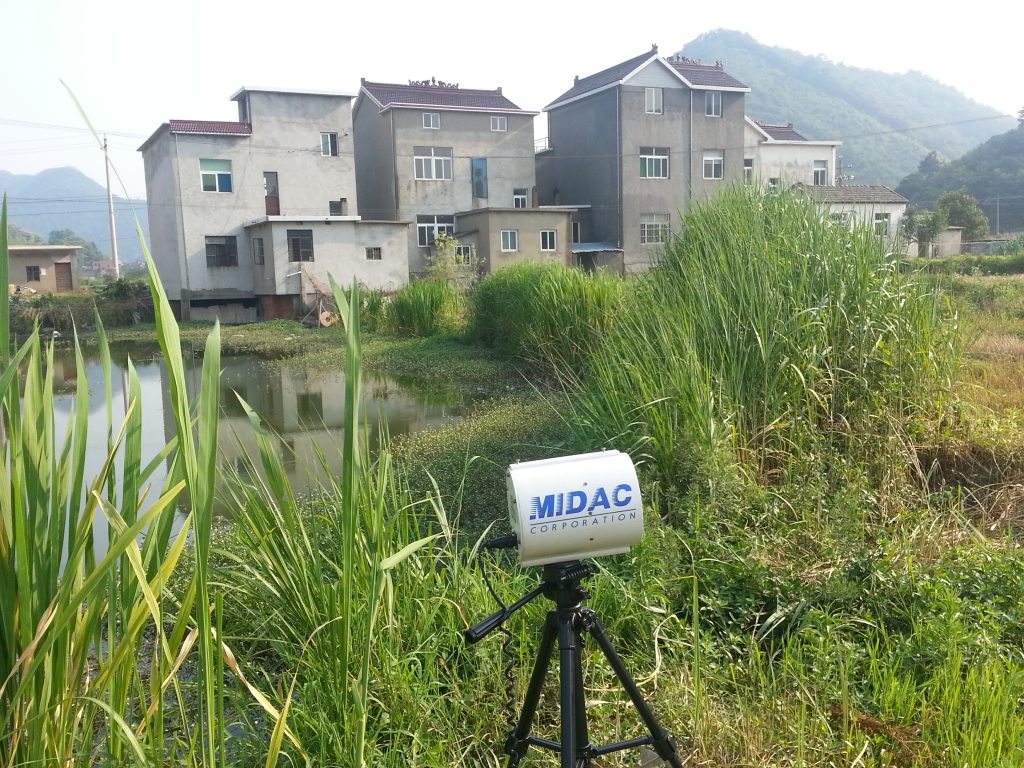
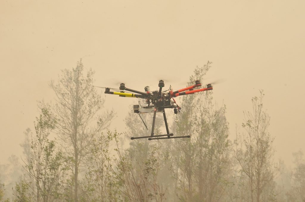
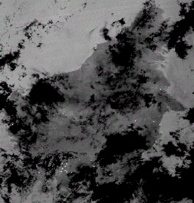
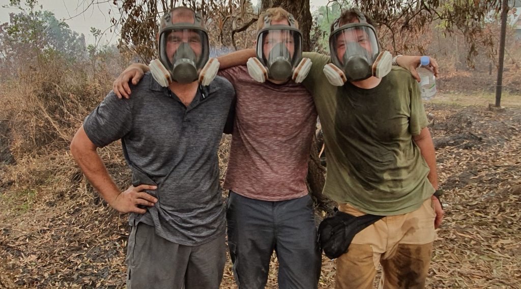
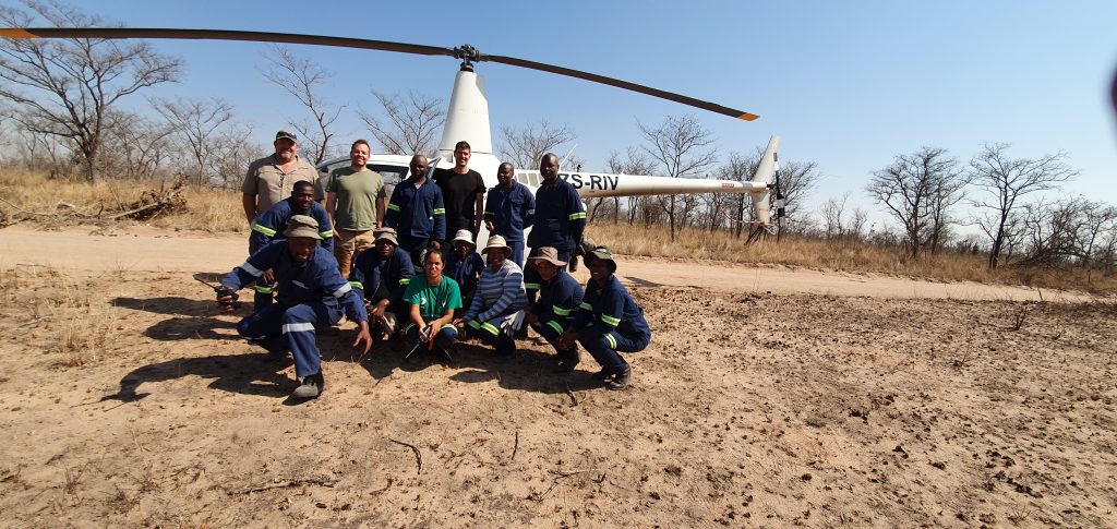
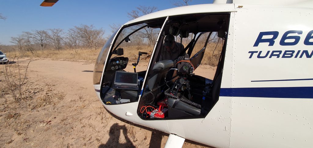
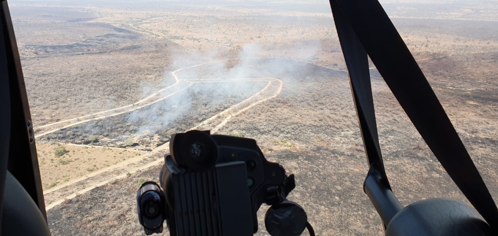
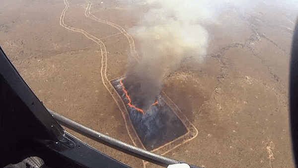
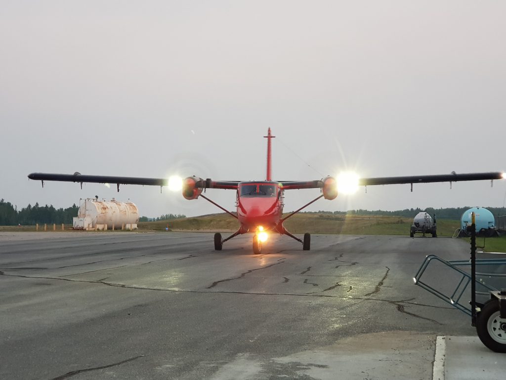
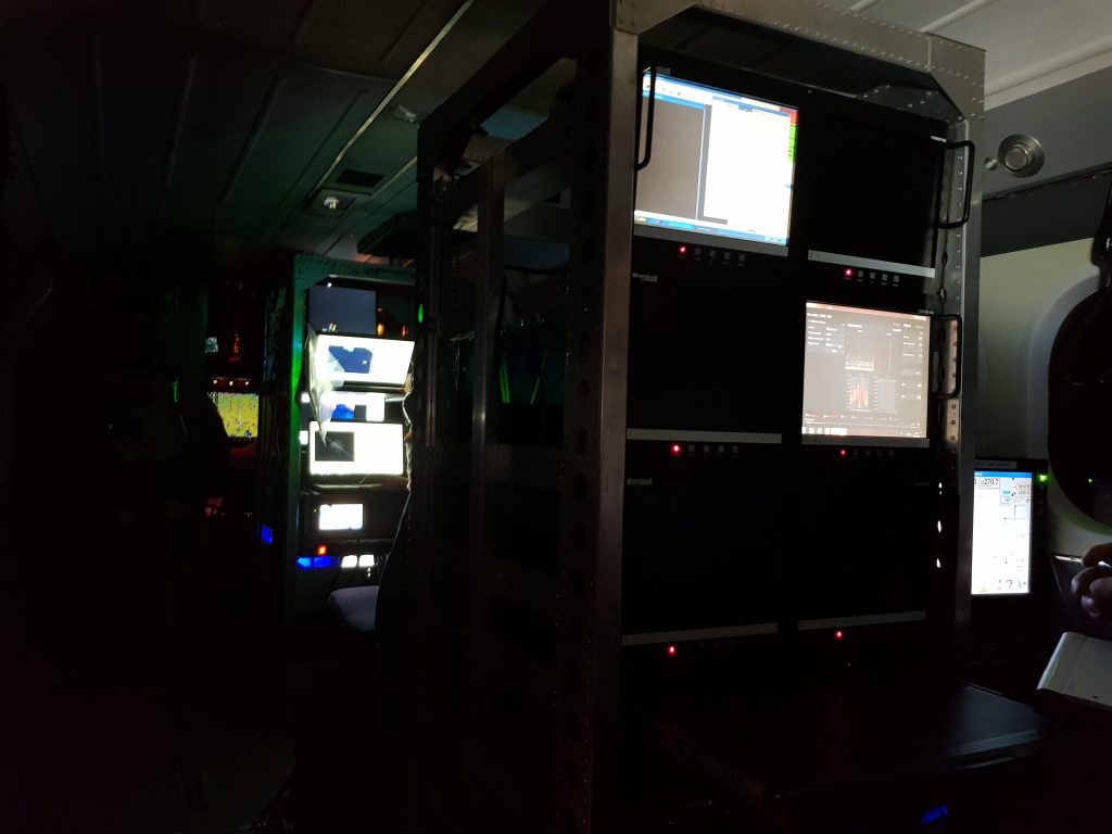
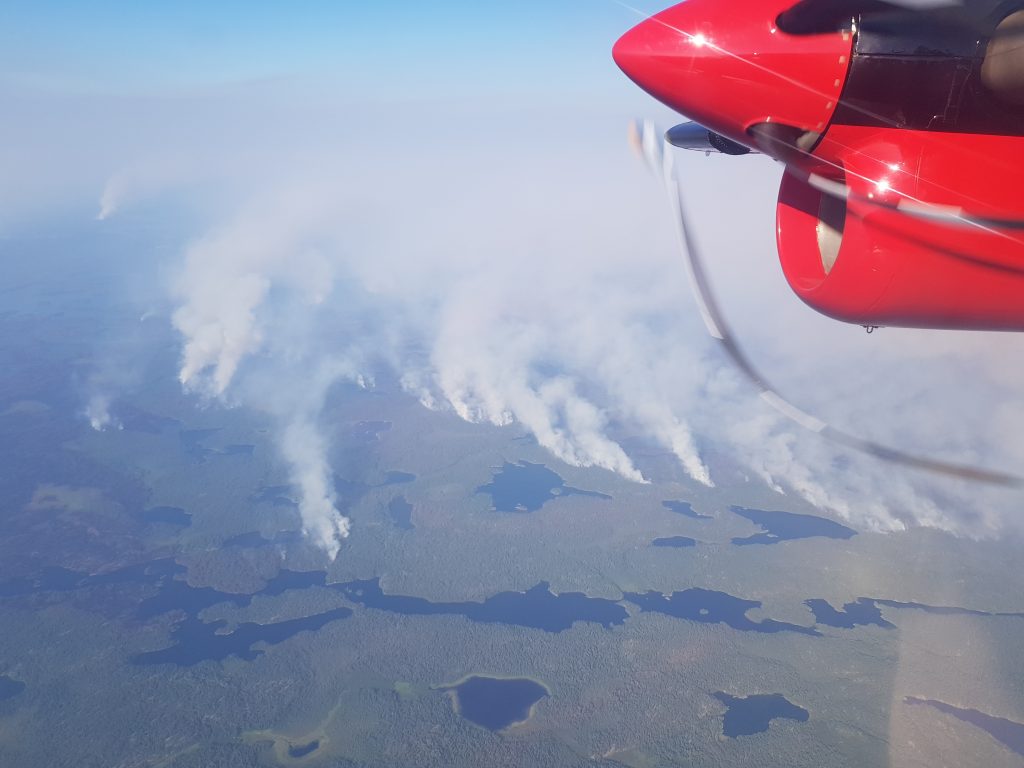
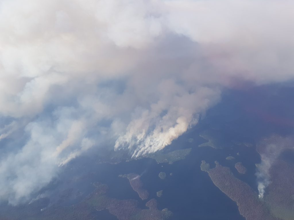
To aid evaluation of these satellite products we perform various types of measurement, but commonly this involves measuring the same type of fire characteristics as determined form the satellite views but from aircraft, which provide much more detailed and thus more precise information. Airborne platforms such as helicopter and fixed wing aircraft are capable of providing excelling platforms to mount the remote sensing equipment required to validate the satellite-derived information. Typically this requires flying above a fire in the airborne platform that is large enough to be detected in the satellite data, just as the satellite is making its overpass. The images of Canadian fires below taken from the Twin Otter aircraft are of the same fires highlighted in the above Sentinel-3 SLSTR scene.
![]()
King’s College London, Bush House (NE wing), 30 Aldwych, London, WC2B 4BG