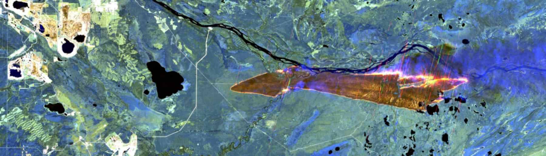
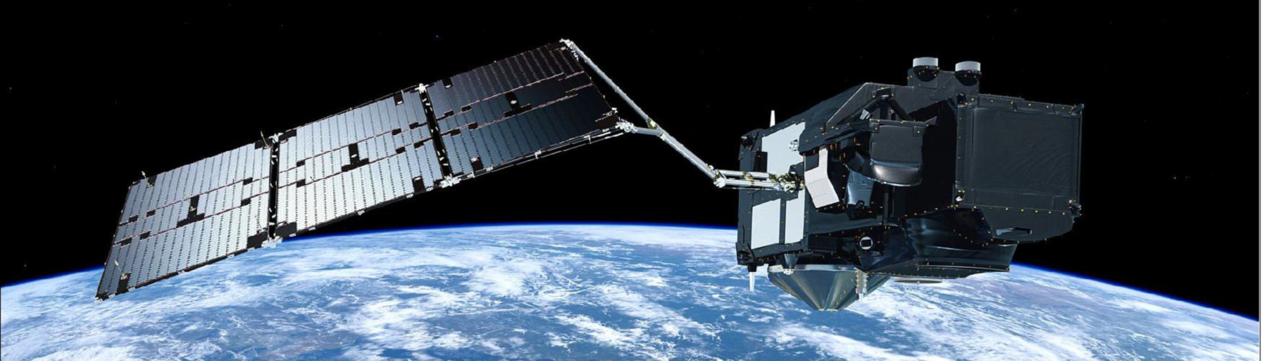
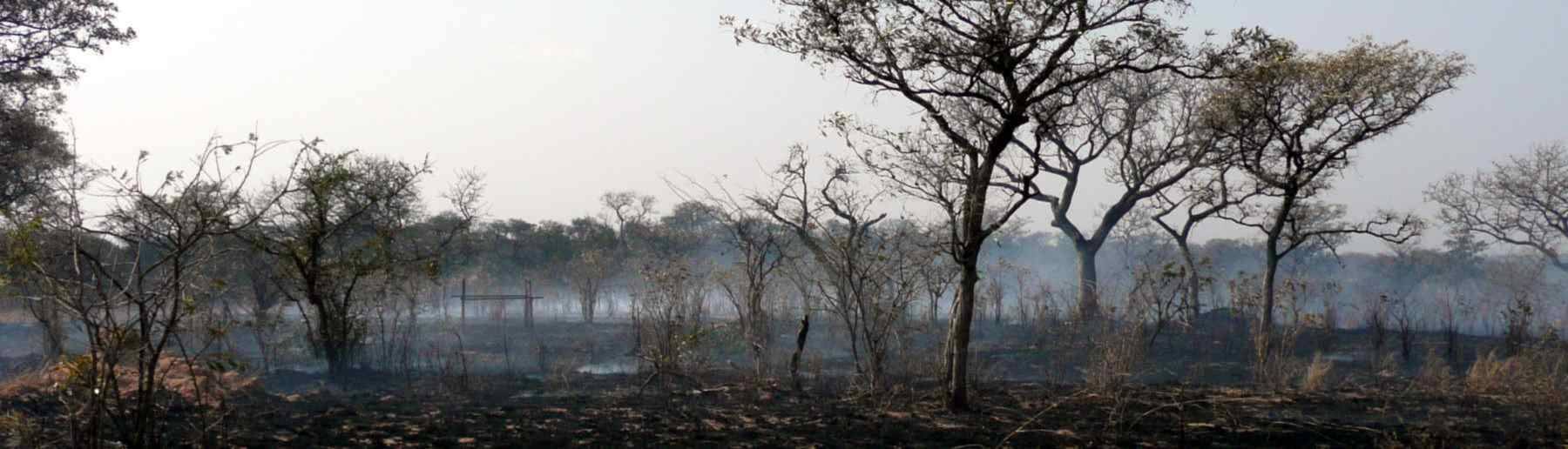


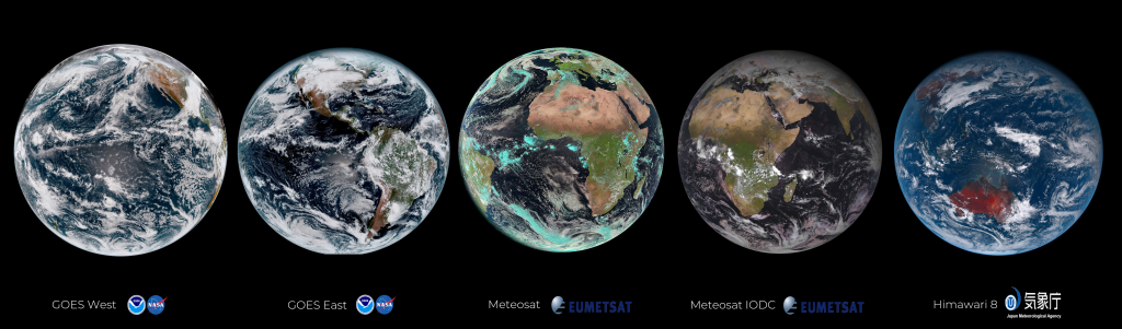
Our group are responsible for designing algorithms underlying a series of operational geostationary active fire products. The algorithms are used to generate data products delivered routinely by Space Agencies such as EUMETSAT and also the Copernicus Atmosphere Monitoring Service (CAMS). These products take data from the current set of geostationary meteorological satellites shown below, and using variations of the same Fire Thermal Anomaly (FTA) active fire detection algorithm detect fires burning within each imaging disk.
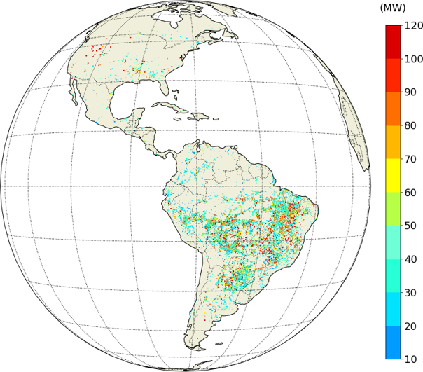
One of the variables derived at the location of each detected active fire pixel is the fire radiative power (FRP), which is a measure of the strength of the fire and is correlated to the rate of combustion and smoke emission. The MIR-radiance method of FRP retrieval was developed by the group, and exploits the near constant relationship between emitted spectral radiance at certain combinations of wavelength and temperature, and total emitted power. The approach enables the estimation of FRP using the same equation with different satellite instruments, for example at all the active fire pixel detected by the FTA algorithm in each geostationary satellites imaging disk. The MIR radiance approach to FRP retrieval is currently used operationally in the MODIS Collection 6 active fire products, the VIIRS AF products, as well as the Meteosat, GOES and Himawari FRP products generated using algorithms developed by our team and its collaborators. These geostationary AF products include detail on each detected active fire pixel – as well as a classification of each pixel in the scene. Immediately below is the FTA algorithm output produced using data from the Meteosat SEVIRI sensor (centre disk in the image above), whilst below that we show the full disk FRP record for all active fire pixels detected in one month across the GOES-16 imaging disk.
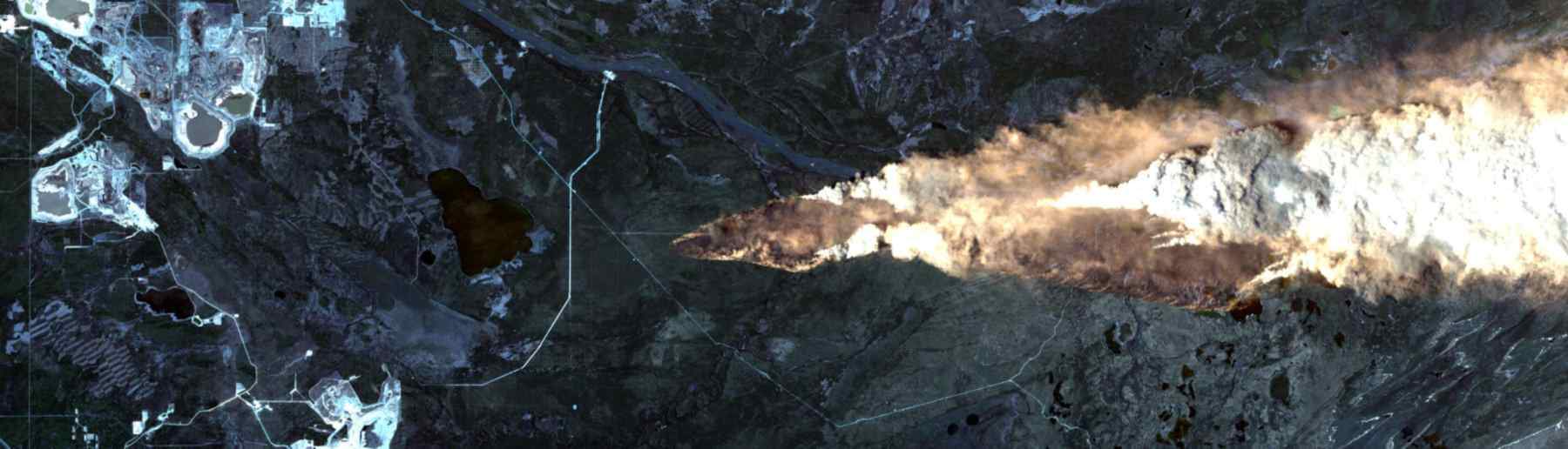
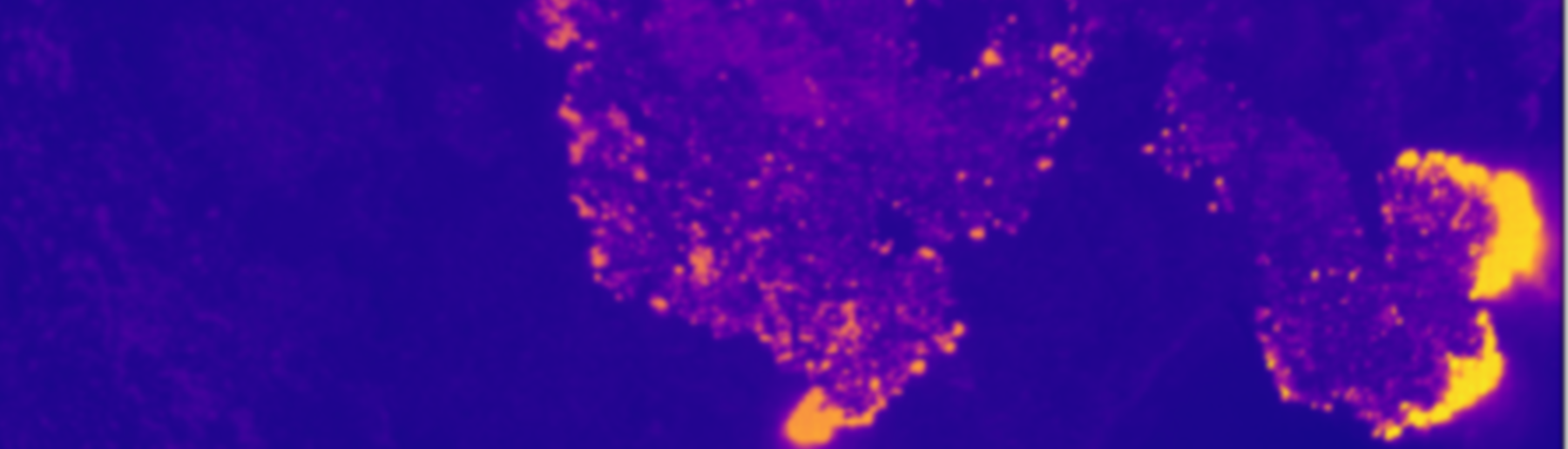
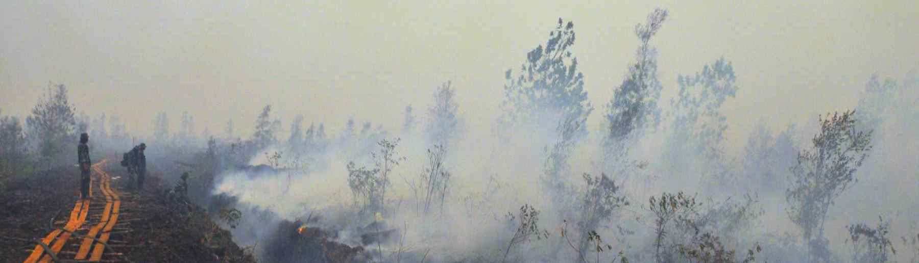
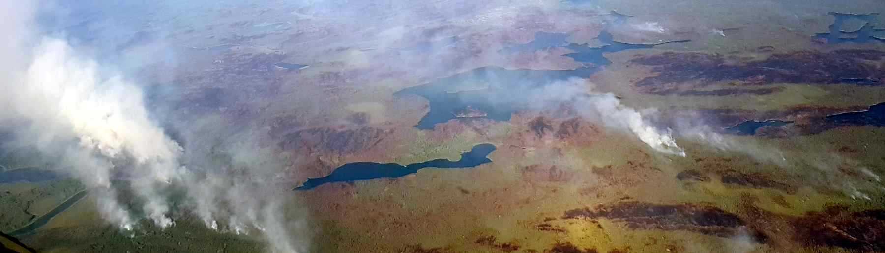
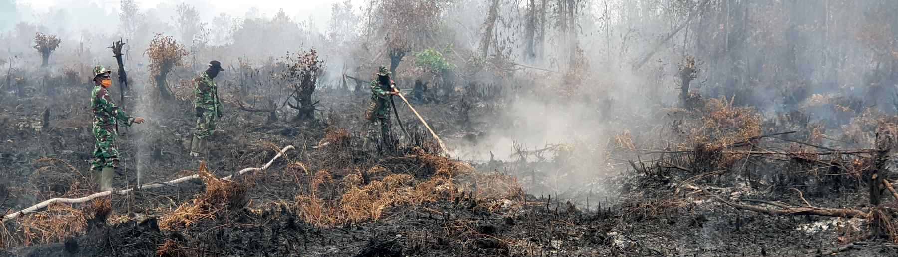
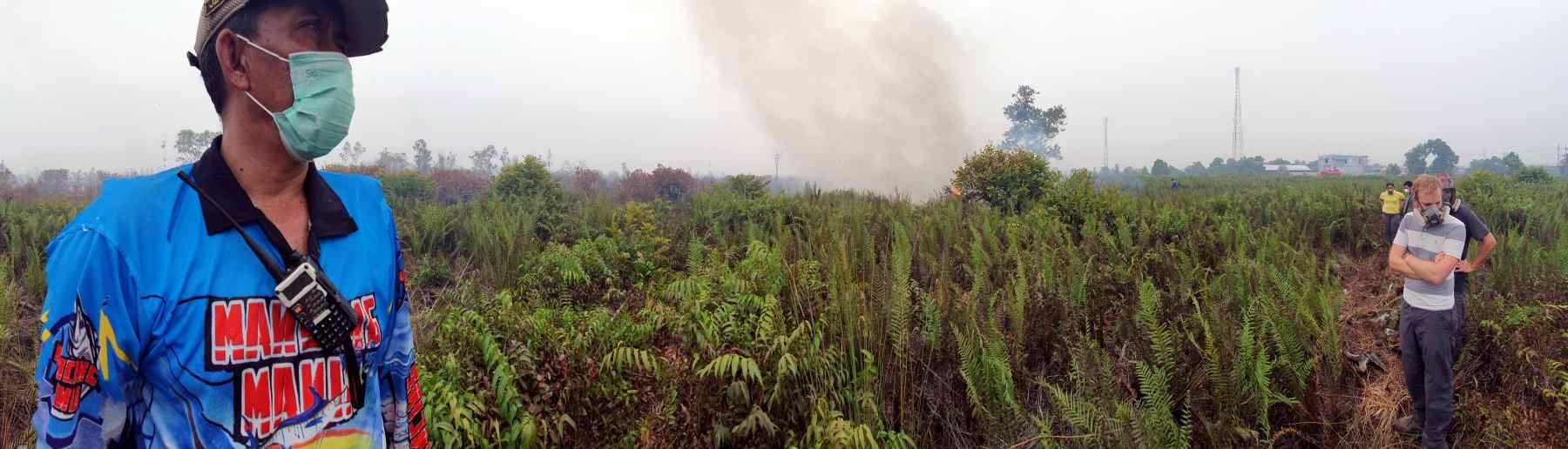
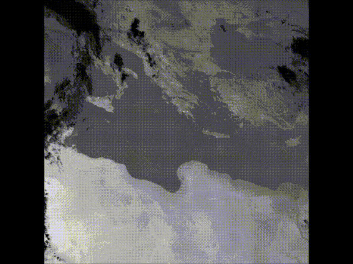
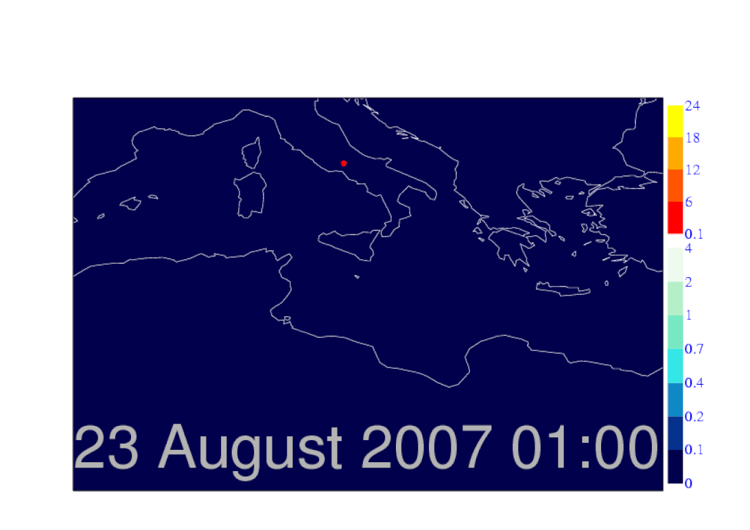
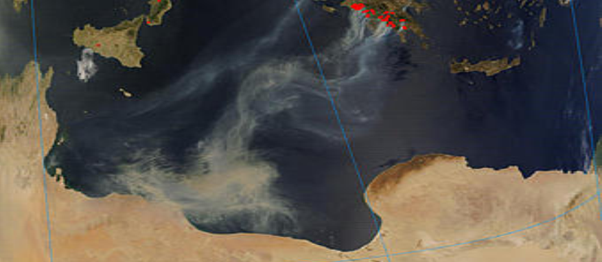
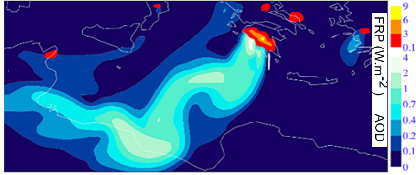
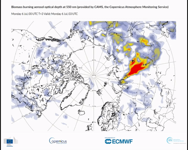
Each sensors middle infrared (MIR) spectral channel is the one most vital to support active fire (AF) detection and FRP retrieval, but many spectral channels are used to help detect the lowest FRP fires whilst minimising false alarms from phenomena such as sunglint or solar-heated bare ground. The FRP for each detected AF pixel can be used to calculate the amount of material the fire is consuming and the amount of smoke it is producing. Using such data within atmospheric models enables the fires effect on the atmosphere to be simulated and understood, and even forecast somewhat in advance of the smoke reaching certain areas using meteorological forecasting techniques. Below (left) is an example of a SEVIRI MIR channel time-series of the southern Europe and north African part of the SEVIRI imaging disk, where fires are burning on the Greek island of Peloponnese. The fires can be identified via their intense signals that show up as bright pixels in the MIR channel imagery. SEVIRI provides data every 15 minutes and this speeded up time-lapse represents a few days of such data. Below (right) is a simulated map of aerosol optical depth @ 550 nm (blue colours), generated using the FRP retrievals from Meteosat SEVIRI (yellow-red colour) and the atmospheric model used within the Copernicus Atmosphere Monitoring Service (CAMS). The simulation shows the smoke from the fires moving SW across north Africa. Subsequently the winds shifted and the smoke was forecast to blow across Italy, significantly affecting air quality there around 3 days after its was first emitted in Greece.
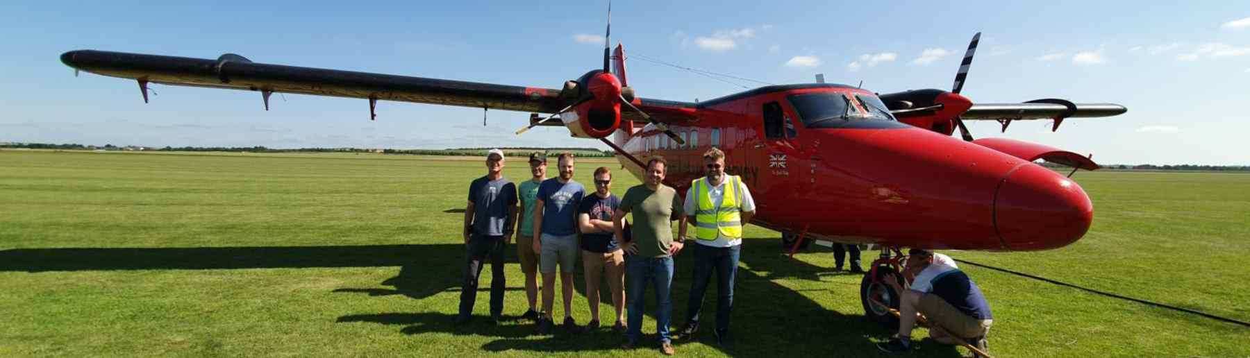
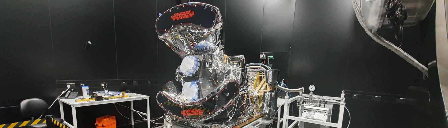
Our group are also responsible for algorithms used by space agencies to deliver information from polar-orbiting satellites. This includes the information contained within the Active Fire Detection and FRP Products generated from data collected by the Sea and Land Surface Temperature (SLSTR) which operates on the two concurrently orbiting Sentinel-3 satellites of Europe’s Copernicus Programme. Sentinel-3A and -3B were launched in 2016 and 2018 respectively and the instrument possesses many design features enabling it to significantly improve on the AF data generated from the prior ATSR instrument series. This includes a wider swath to generate full global coverage every day and the inclusion of two MIR channels of different gain settings that enable the derivation of FRP values at both high and low FRP fires. These FRP data products are available from the Sentinel Data Hub.
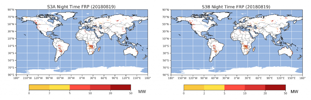
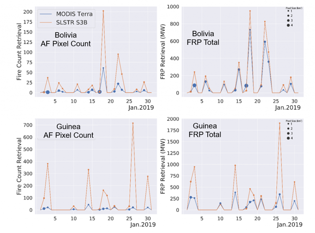
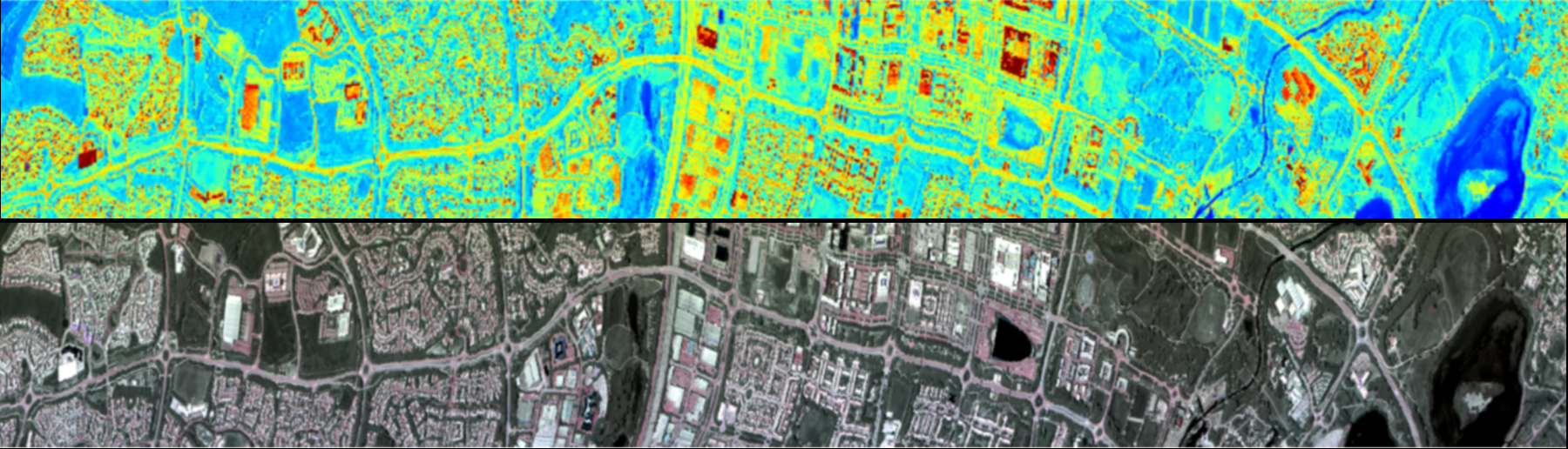
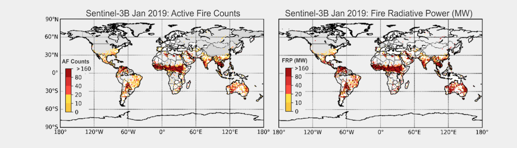
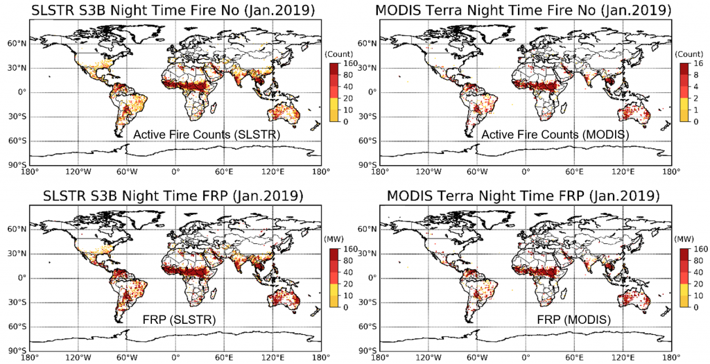
A great deal of work goes into the evaluation of these types of operational active fire product, and the algorithms and parameters are quite regularly tweaked to improve performance. The below image shows a comparison between the spatial pattern of night-time FRP retrieved from Sentinel-3B for January 2019 (here the data in the Level-2 product is gridded and plotted), compared to the same data from Terra MODIS. Very similar spatial patterns are seen, indicating a good degree of broad agreement between the two datasets. A similar comparison of AF pixel counts shows that the SLSTR product includes many more AF detections, but the grid-cell FRP totals shown in Figure 6 are similar between the two records because the additional AF pixels that SLSTR detects in many of the grid cells are dominated by low FRP values.
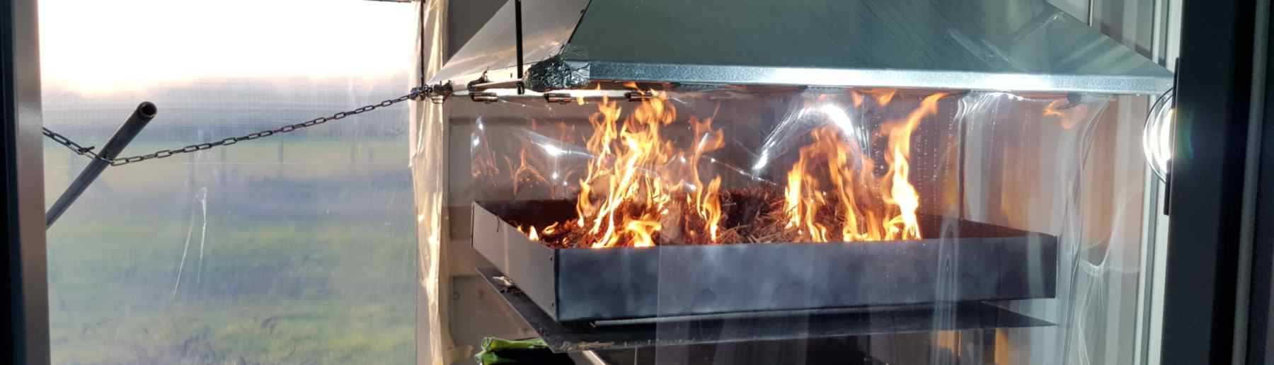
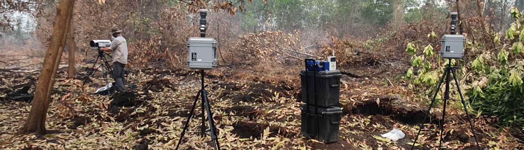
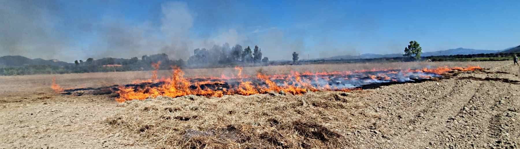
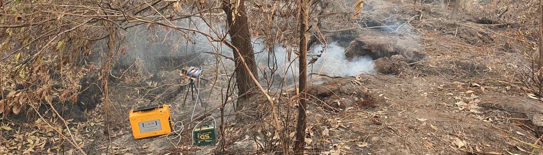
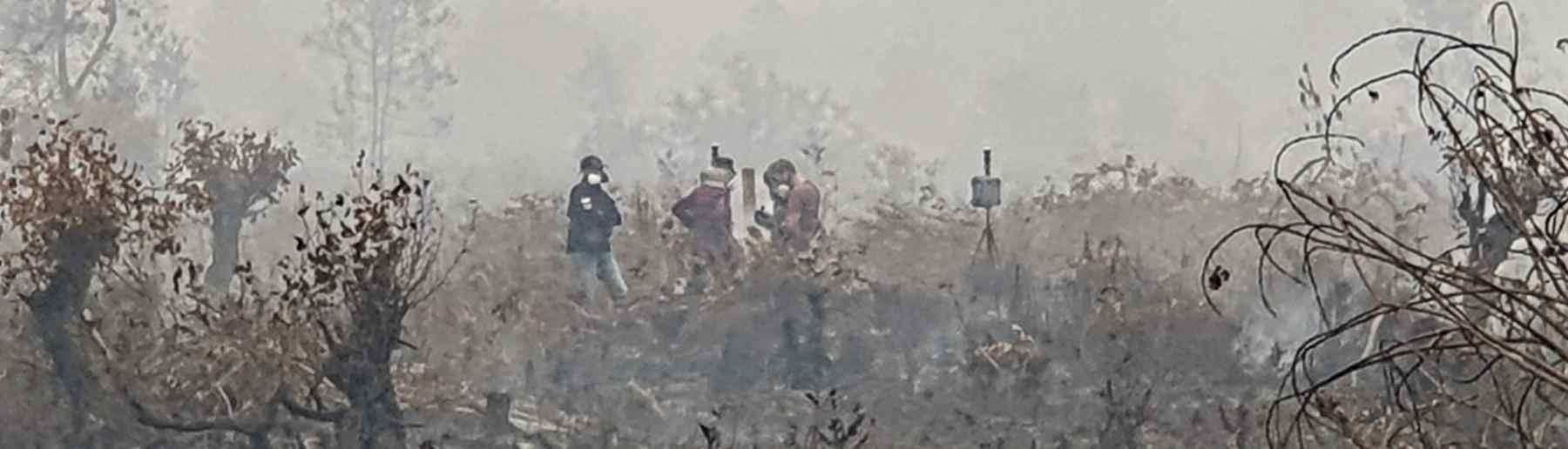
In addition to operational algorithm development, we also produce experimental algorithms with the objective of enhancement our operational outputs. Recent experimental developments include: a small fire bias correction technique for the adjustment geostationary fire radiative power estimates; new active fire detection approaches for the VIIRS 375m I-Band channels with a focus on agricultural burning; and a SWIR based extension of the MIR-Radiance method that enables single channel characterisation of industrial gas flares for the first time and has been used to generate the longest term analysis of global gas flaring activity to date.
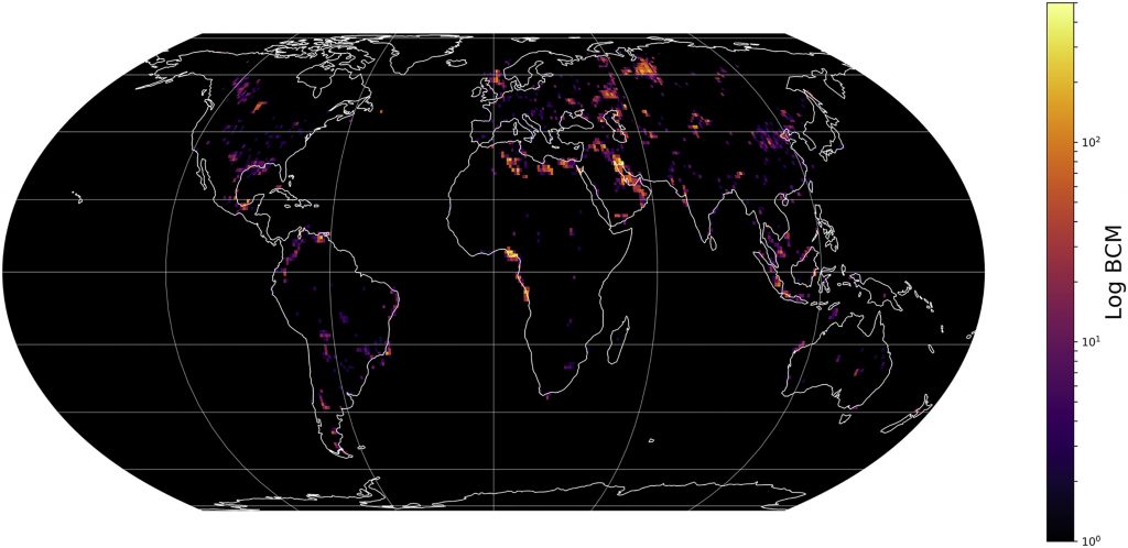
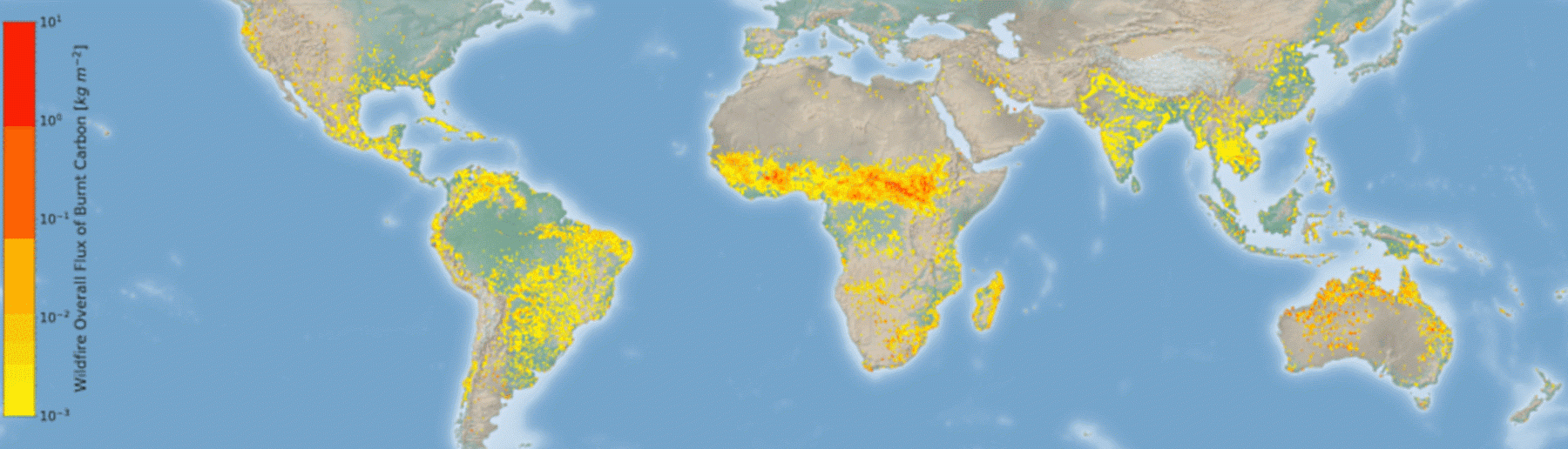
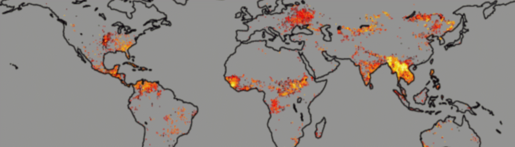
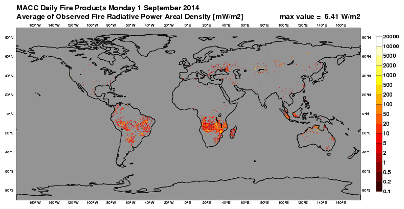
The global fire assimilation system (GFAS) provides one of the essential inputs to the Copernicus Atmosphere Monitoring Service (CAMS). Operated at ECMWF (The European Centre for Medium-Range Weather Forecasts), the operational version of GFAS delivers near-real-time estimates of landscape fire emissions – both trace gases and aerosols. It does this using satellite observations of Fire Radiative Power (FRP) – and converts these to estimates of CO2, CO, CH4, black carbon aerosol, organic carbon aerosol, total carbon aerosol, PM2.5, total particulate matter, H2, NOx, N2O, SO2, and non-methane volatile organic compounds (NMVOCs) emissions (over 40 species in all). These emissions estimates are key inputs to the CAMS modelling systems that provide information on the state of our atmosphere – both the Real-time Global Products, the Forecast-only Global Products, the Global Reanalysis Products and the Regional Products. The GFAS fire emissions themselves are also part of the CAMS product portfolio, and currently King’s lead the GFAS development project that is enabling new polar-orbit and geostationary satellite FRP data streams to be used within GFAS – and which is being designed to provide improved capabilities for the future iteration of the operational GFAS, with respect to temporal frequency, accuracy and independence from other fire emissions inventories.
![]()
King’s College London, Bush House (NE wing), 30 Aldwych, London, WC2B 4BG